QUESTIONS? CALL OR TEXT! 1 (877) 921-6277 or (403) 266-2241
WE SHIP EVERYWHERE!

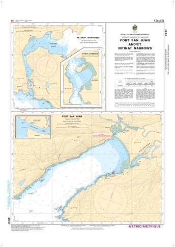
Navigate the rugged transition between the Juan de Fuca Strait and the open Pacific with the professional authority of the Canadian Hydrographic Service (CHS). Chart 3647 is the definitive "road map" for mariners, providing essential high-resolution plans for Port San Juan (Port Renfrew) and the technical, tide-dependent passage of Nitinat Narrows.
The coastline near the West Coast Trail is famous for its heavy swells and technical river entrances. CHS Chart 3647 provides the "ground-truth" data required for safe pilotage in these high-consequence areas:
Nitinat Narrows (1:6,000 Plan): Offers the extreme detail necessary to navigate the narrow, rock-strewn channel of the Narrows. This data is vital for timing the slack water required to safely enter Nitinat Lake.
Port San Juan (1:18,000 Plan): Detailed bathymetry for the approaches to Port Renfrew, including the San Juan River and Gordon River deltas, ensuring safe clearance from shifting bars and submerged hazards.
Essential Anchorage & Shoreline Data: Explicitly marks the nature of the sea bottom, elevations, and navigational aids, which are critical for vessels seeking refuge from Pacific gales.
Marine Safety for Explorers: Whether for commercial fishing, West Coast Trail support, or world-class windsurfing at Nitinat, this chart provides the accuracy needed to manage powerful coastal currents and breaking surf.
With increasing recreational activity and the development of ocean resources, the role of CHS Chart 3647 is more vital than ever. Specifically designed to meet the rigorous requirements of marine navigation, this chart ensures that mariners can transition from the open Pacific into these sheltered but technical waters with total confidence.
| Feature | Details |
| Chart Number | 3647 |
| Region | Pacific Coast (West Coast Vancouver Island) |
| Scale | 1:15,000 (Port San Juan) / 1:6,000 (Nitinat Narrows) |
| Dimensions | 36" x 48" (Standard Paper Size) |
| Publisher | Canadian Hydrographic Service (CHS) |
| Key Coverage | Port San Juan, Nitinat Narrows, Port Renfrew, Nitinat Lake |
| Compliance | Meets official carriage requirements for safe marine navigation |