QUESTIONS? CALL OR TEXT! 1 (877) 921-6277 or (403) 266-2241
WE SHIP EVERYWHERE!

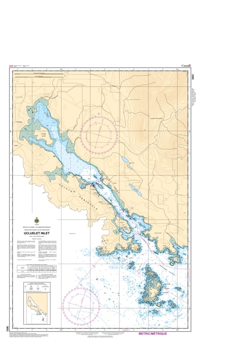
Navigate the gateway to Barkley Sound and the Pacific Rim with the professional authority of the Canadian Hydrographic Service (CHS). Chart 3653 is the definitive 1:12,000 scale "road map" for mariners, providing the high-resolution data required for safe entry into Ucluelet Inlet, a vital refuge and supply hub for West Coast mariners.
Ucluelet is a high-traffic maritime environment where commercial fishing vessels, whale-watching fleets, and recreational cruisers converge. CHS Chart 3653 provides the "ground-truth" data required for safe pilotage:
Amphitrite Point Detail: Features the critical bathymetry needed for rounding the rugged Amphitrite Point lighthouse, ensuring safe clearance from the heavy Pacific swells and rocky shoals at the harbor entrance.
Comprehensive Inlet Mapping: Provides granular detail for the entire length of the inlet, including Spring Cove, Stuart Bay, and the technical navigation required for the Inner Basin.
Marina and Dockage Precision: Identifies the configuration of public and private docks, essential for deep-draft vessels and recreational boaters seeking a secure berth.
Hazard & Navigational Aids: Explicitly marks submerged rocks, dredging limits, and the latest positions of lights and buoys that guide vessels through the narrow stretches of the inlet.
With Ucluelet's role as a primary center for fishing, tourism, and marine resources, the reliability of Chart 3653 is more vital than ever. Specifically designed to meet the rigorous requirements of marine navigation, this official CHS chart delivers the accuracy and detail needed to navigate from the open sea to a sheltered slip with total confidence.
| Feature | Details |
| Chart Number | 3653 |
| Region | Pacific Coast (West Coast Vancouver Island) |
| Scale | 1:12,000 (Large-Scale Detail) |
| Dimensions | 34" x 46" (Standard Paper Size) |
| Publisher | Canadian Hydrographic Service (CHS) |
| Key Coverage | Ucluelet Inlet, Amphitrite Point, Spring Cove, Ucluelet Inner Basin |
| Compliance | Meets official carriage requirements for safe harbor navigation |