QUESTIONS? CALL OR TEXT! 1 (877) 921-6277 or (403) 266-2241
WE SHIP EVERYWHERE!

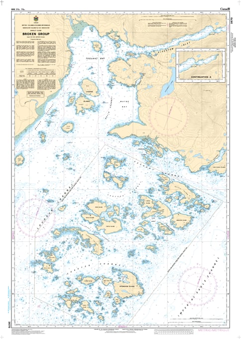
Navigate the maze of over 100 islands and rocky outcrops with the professional authority of the Canadian Hydrographic Service (CHS). Chart 3670 is the definitive 1:20,000 scale "road map" for mariners, specifically designed for the intricate waters of the Broken Group Islands in the heart of Barkley Sound.
The Broken Group is a world-class destination for recreational boaters, kayakers, and wildlife explorers, but its waters are filled with hidden hazards. CHS Chart 3670 provides the "ground-truth" data required for safe passage:
High-Resolution Island Mapping: Offers the granular detail necessary to navigate the narrow passages between Effingham, Turtle, and Gilbert Islands.
Safe Passage and Channels: Detailed bathymetry for the Coaster Channel, Peacock Channel, and Thiepval Channel, ensuring larger vessels can move through the archipelago without grounding.
Safety for Small Craft: Explicitly marks the locations of drying rocks, reefs, and shoals that are critical for kayakers and small boaters navigating the inter-island zones.
Seafloor & Anchorage Data: Identifies the nature of the sea bottom (sand, mud, or rock), providing essential information for securing safe anchorages within the National Park.
With the increasing popularity of eco-tourism and recreational boating on Vancouver Island’s west coast, the reliability of Chart 3670 is more vital than ever. Whether you are a commercial guide leading a kayak tour or a recreational cruiser exploring the Pacific Rim, this official CHS chart delivers the accuracy and detail needed to navigate this sensitive marine environment with total confidence.
| Feature | Details |
| Chart Number | 3670 |
| Region | Pacific Coast (Barkley Sound / West Coast Vancouver Island) |
| Scale | 1:20,000 |
| Dimensions | 36" x 48" (Standard Paper Size) |
| Publisher | Canadian Hydrographic Service (CHS) |
| Key Coverage | Broken Group Islands, Sechart, Coaster Channel, Effingham Island |
| Compliance | Meets official carriage requirements for safe marine navigation |