QUESTIONS? CALL OR TEXT! 1 (877) 921-6277 or (403) 266-2241
WE SHIP EVERYWHERE!

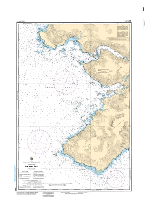
Navigate the "Cape of Storms" with the professional authority of the Canadian Hydrographic Service (CHS). Chart 3680 is the definitive 1:38,317 scale "road map" for mariners, providing the high-resolution data required for safe passage through Brooks Bay and the formidable waters surrounding the Brooks Peninsula.
The Brooks Peninsula is legendary among mariners for its unique weather systems, powerful wind accelerations, and converging currents. CHS Chart 3680 provides the "ground-truth" data required for safe pilotage in this high-consequence environment:
Klaskish & Nasparti Inlets: Features critical bathymetry for entering the sheltered (yet technical) waters of Klaskish Inlet and Nasparti Inlet, identifying safe leads through narrow channels.
Brooks Peninsula Coverage: Detailed mapping for the northern and western flanks of the peninsula, including Clerke Point and the approaches to Columbia Cove, a vital refuge for vessels rounding the cape.
Solander Island & Hazards: Provides the resolution needed to safely clear Solander Island and the numerous sea stacks and submerged reefs that characterize this "lost world" coastline.
Seafloor & Anchorage Intelligence: Explicitly marks the nature of the sea bottom, elevations, and coastal characteristics, essential for identifying secure anchorages in remote bays like Battle Bay.
As the primary reference for vessels transiting between Kyuquot and Quatsino Sounds, the reliability of Chart 3680 is paramount. Whether you are a commercial fisher timing a crossing of the peninsula or a recreational explorer seeking the sandy beaches of the Mᑫuqʷin/Brooks Peninsula Provincial Park, this official CHS chart delivers the accuracy and detail needed to navigate with total confidence.
| Feature | Details |
| Chart Number | 3680 |
| Region | Pacific Coast (West Coast Vancouver Island) |
| Scale | 1:38,317 |
| Dimensions | 36" x 47" (Standard Paper Size) |
| Publisher | Canadian Hydrographic Service (CHS) |
| Key Coverage | Brooks Bay, Klaskish Inlet, Nasparti Inlet, Columbia Cove, Clerke Point |
| Compliance | Meets official carriage requirements for safe marine navigation |