QUESTIONS? CALL OR TEXT! 1 (877) 921-6277 or (403) 266-2241
WE SHIP EVERYWHERE!

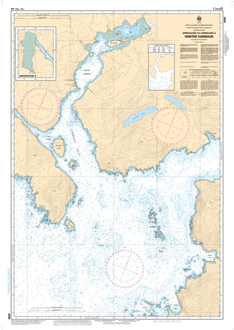
Navigate the rugged northwestern threshold of Vancouver Island with the professional authority of the Canadian Hydrographic Service (CHS). Chart 3686 is a specialized 1:15,000 scale "road map" for mariners, providing the granular detail required for safe passage through the Approaches to Winter Harbour, a vital refuge for vessels transiting the "Graveyard of the Pacific."
The western entrance to Quatsino Sound is known for powerful swells and complex rocky features. CHS Chart 3686 provides the "ground-truth" data required for safe pilotage in this high-energy environment:
Forward Inlet & Winter Harbour: Features the high-resolution mapping necessary to navigate the sheltered waters of Forward Inlet, providing the definitive guide to the docks and facilities of Winter Harbour.
Kains Island & Lighthouse Detail: Provides critical bathymetry for rounding Kains Island, identifying safe leads and submerged hazards at the very mouth of Quatsino Sound.
Browning Provincial Park Access: Offers the resolution needed to explore the secluded anchorages of the nearby marine parks, ensuring safe clearance from drying reefs and shoals.
Seafloor & Hazard Intelligence: Explicitly marks the nature of the sea bottom, elevations, and coastal configuration, allowing mariners to identify secure anchorages and avoid dangerous rock formations in varying sea states.
With the increasing popularity of remote eco-tourism and the continued importance of the commercial fishing fleet, the reliability of Chart 3686 is paramount. Specifically designed to meet the rigorous requirements of marine navigation, this official CHS chart delivers the accuracy and detail needed to move from the open sea to a sheltered berth with total confidence.
| Feature | Details |
| Chart Number | 3686 |
| Region | Pacific Coast (North-West Vancouver Island) |
| Scale | 1:15,000 |
| Dimensions | 36" x 49" (Standard Paper Size) |
| Publisher | Canadian Hydrographic Service (CHS) |
| Key Coverage | Winter Harbour, Forward Inlet, Kains Island, Quatsino Sound Entrance |
| Compliance | Meets official carriage requirements for safe marine navigation |