QUESTIONS? CALL OR TEXT! 1 (877) 921-6277 or (403) 266-2241
WE SHIP EVERYWHERE!

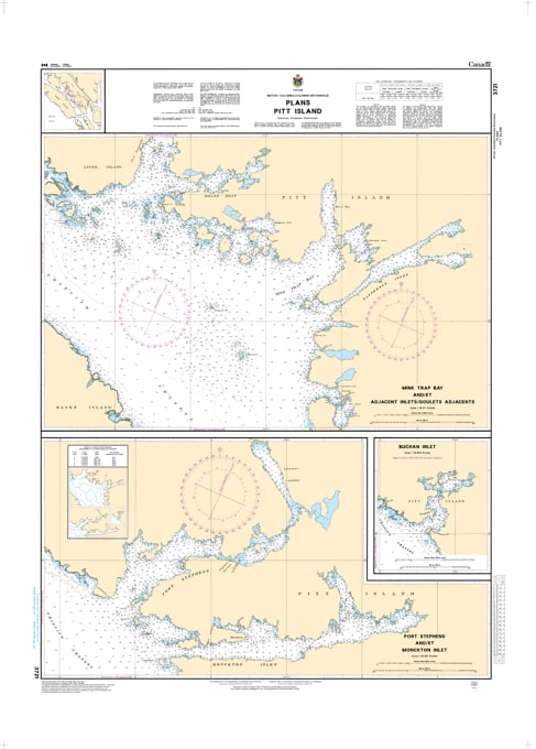
Navigate the secluded and intricate waterways of the North Coast with the professional authority of the Canadian Hydrographic Service (CHS). Chart 3721 is a specialized 1:18,300 scale "road map" for mariners, providing the granular detail required for safe pilotage through the rugged harbors and inlets on the west coast of Pitt Island.
Northern British Columbia's coastline is characterized by deep fjords and hidden bays that require precise situational awareness. CHS Chart 3721 provides the "ground-truth" data required for safe entry into several key destinations:
Mink Trap Bay & Adjacent Inlets: Features high-resolution mapping for this complex system of inlets, identifying safe leads through narrow passages.
Port Stephens & Monckton Inlet: Provides the critical resolution needed to navigate these sheltered harbors, essential for commercial fishing vessels and recreational cruisers seeking refuge along the Inside Passage.
Buchan Inlet: Detailed bathymetry and shoreline configuration for this technical entrance, helping mariners avoid submerged hazards and drying reefs.
Hazard & Seafloor Identification: Explicitly marks seafloor characteristics (rock, sand, or mud), elevations, and navigational aids, which are vital for securing safe anchorages in these remote northern waters.
With the growth of eco-tourism and the continued importance of commercial shipping and fishing in Northern BC, the reliability of Chart 3721 is more vital than ever. Specifically designed to meet the rigorous requirements of marine navigation, this official CHS chart delivers the accuracy and detail needed to explore the western shores of Pitt Island with total confidence.
| Feature | Details |
| Chart Number | 3721 |
| Region | Pacific Coast (Northern BC / Pitt Island) |
| Scale | 1:18,300 (High-Detail Plans) |
| Dimensions | 36" x 43" (Standard Paper Size) |
| Publisher | Canadian Hydrographic Service (CHS) |
| Key Coverage | Mink Trap Bay, Port Stephens, Monckton Inlet, Buchan Inlet |
| Compliance | Meets official carriage requirements for safe harbor navigation |