QUESTIONS? CALL OR TEXT! 1 (877) 921-6277 or (403) 266-2241
WE SHIP EVERYWHERE!

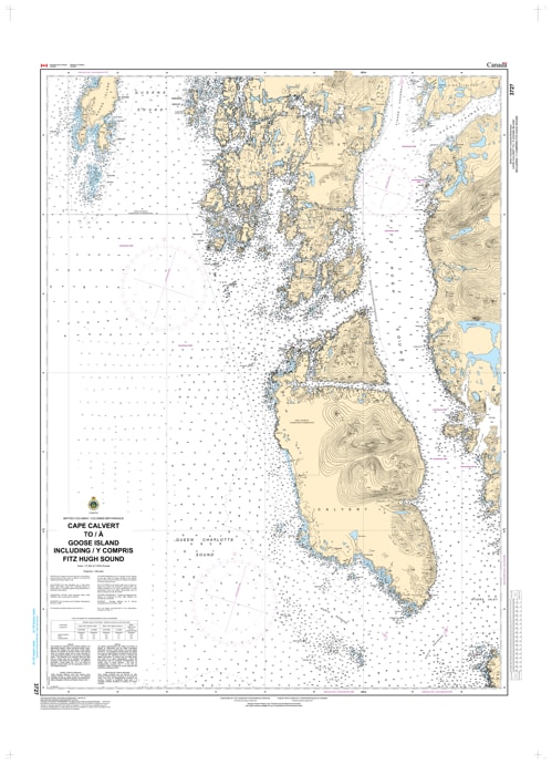
Navigate the legendary transition from the open Pacific to the sheltered Inside Passage with the professional authority of the Canadian Hydrographic Service (CHS). Chart 3727 is the definitive 1:73,584 scale "road map" for mariners, providing the comprehensive coverage required for safe passage through Fitz Hugh Sound, Hakai Passage, and the waters surrounding the Goose Islands.
Fitz Hugh Sound is a critical maritime corridor where coastal tugs, commercial fishing fleets, and long-range cruisers intersect. CHS Chart 3727 provides the "ground-truth" data required for safe pilotage in this intricate environment:
Strategic Coverage: Provides the resolution necessary to navigate from the open waters of Queen Charlotte Sound into the protected reaches of Fitz Hugh Sound, identifying safe leads through the technical Hakai Passage.
Calvert & Goose Islands: Features critical mapping for the rugged coastlines of Calvert Island and the Goose Islands, essential for situational awareness and safe clearance from submerged hazards in the Hakai Luxvbalis Conservancy.
Complex Shoreline Mapping: Detailed bathymetry and configuration for Hecate Island, Hunter Island, and the numerous inlets along the central coast, identifying safe havens from Pacific swells.
Essential Navigational Data: Explicitly marks the nature of the sea bottom (rock, sand, or mud), elevations, and navigational aids, which are vital for securing safe anchorages in these remote northern waters.
With the increasing importance of eco-tourism in the Hakai region and the continued popularity of the Inside Passage for recreational cruising, the reliability of Chart 3727 is more vital than ever. Specifically designed to meet the rigorous requirements of marine navigation, this official CHS chart delivers the accuracy and detail needed to navigate with total confidence.
| Feature | Details |
| Chart Number | 3727 |
| Region | Pacific Coast (Central BC Coast) |
| Scale | 1:73,584 |
| Dimensions | 36" x 44" (Standard Paper Size) |
| Publisher | Canadian Hydrographic Service (CHS) |
| Key Coverage | Fitz Hugh Sound, Cape Calvert, Goose Island, Hakai Passage, Calvert Island |
| Compliance | Meets official carriage requirements for safe marine navigation |