QUESTIONS? CALL OR TEXT! 1 (877) 921-6277 or (403) 266-2241
WE SHIP EVERYWHERE!

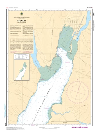
Navigate the deep-water terminus of the Portland Canal with the professional authority of the Canadian Hydrographic Service (CHS). Chart 3794 is the definitive 1:12,000 scale "road map" for mariners, providing the high-resolution data required for safe passage into Stewart, British Columbia, and the international boundary waters shared with Hyder, Alaska.
The Port of Stewart is a vital link for the "Golden Triangle" mineral region, hosting handymax and panamax vessels year-round. CHS Chart 3794 provides the "ground-truth" data required for safe operations in this strategic fjord:
Terminal & Wharf Detail: Features the high-detail mapping necessary for approaching Stewart Bulk Terminals and Stewart World Port, identifying precise berth depths and harbor configurations.
Portland Canal Terminus: Detailed bathymetry for the head of the canal where the Salmon and Bear Rivers meet the salt water, identifying shifting siltation patterns and critical sandbars.
International Boundary Awareness: Clearly marks the marine boundary between Canada and the United States, essential for legal and navigational compliance in the shared waters of the Portland Canal.
Anchorage & Seafloor Data: Explicitly marks seafloor characteristics and holding grounds, allowing deep-sea vessels and recreational cruisers to anchor safely in the nearly fresh harbor waters.
As the primary navigational resource for one of the most resource-rich regions in North America, the reliability of Chart 3794 is paramount. Specifically designed to meet the rigorous requirements of marine navigation, this official CHS chart delivers the accuracy needed to navigate the final miles of the 100-kilometer Portland Canal transit with total confidence.
| Feature | Details |
| Chart Number | 3794 |
| Region | Pacific Coast (North-West BC / Alaska Border) |
| Scale | 1:12,000 (High-Resolution Port Plan) |
| Dimensions | 33" x 36" (Standard Paper Size) |
| Publisher | Canadian Hydrographic Service (CHS) |
| Key Coverage | Stewart (BC), Hyder (AK), Portland Canal Terminus |
| Compliance | Meets official carriage requirements for safe harbor navigation |