QUESTIONS? CALL OR TEXT! 1 (877) 921-6277 or (403) 266-2241
WE SHIP EVERYWHERE!

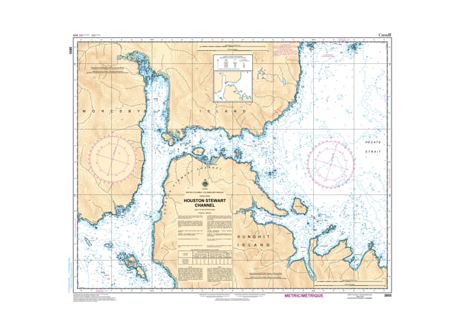
Navigate the intricate heart of southern Haida Gwaii with the professional authority of the Canadian Hydrographic Service (CHS). Chart 3855 is the definitive 1:20,000 scale "road map" for mariners, providing the high-resolution data required for safe passage through Houston Stewart Channel, the primary east-west link between Hecate Strait and the Pacific Ocean.
Houston Stewart Channel is a complex marine environment characterized by powerful tidal flows and a rugged, indented coastline. CHS Chart 3855 provides the "ground-truth" data required for safe pilotage in this strategic corridor:
High-Detail Channel Mapping: Features the resolution necessary to identify safe leads through the narrowest sections of the channel, vital for avoiding the numerous rocky hazards and kelp beds.
Rose Harbour & Gordon Cove: Detailed bathymetry for the historic site of Rose Harbour and surrounding anchorages, identifying safe mooring depths and sea bottom characteristics (rock, sand, or mud).
Kunghit & Moresby Island Shorelines: Precision configuration of the coastlines for both islands, identifying elevations, drying reefs, and essential aids to navigation.
Critical Bathymetry: Shows the nature of the sea bottom and precise water depths, essential for vessels transitioning between the high-energy Pacific and the more sheltered eastern sounds.
As the primary navigational resource for vessels exploring the southern reaches of Gwaii Haanas, the reliability of Chart 3855 is vital. Specifically designed to meet the rigorous requirements of marine navigation, this official CHS chart delivers the accuracy and detail needed to navigate these technical waters with total confidence.
| Feature | Details |
| Chart Number | 3855 |
| Region | Pacific Coast (Southern Haida Gwaii / Gwaii Haanas) |
| Scale | 1:20,000 (High-Resolution Detail) |
| Dimensions | 31" x 39" (Standard Paper Size) |
| Publisher | Canadian Hydrographic Service (CHS) |
| Key Coverage | Houston Stewart Channel, Rose Harbour, Kunghit Island, Gordon Cove |
| Compliance | Meets official carriage requirements for safe marine navigation |