QUESTIONS? CALL OR TEXT! 1 (877) 921-6277 or (403) 266-2241
WE SHIP EVERYWHERE!

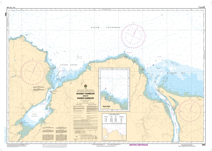
Navigate the gateway to northern Haida Gwaii with the professional authority of the Canadian Hydrographic Service (CHS). Chart 3892 is a vital navigational resource featuring high-resolution plans for the two primary marine hubs on the North Coast of Graham Island. Whether you are transiting the formidable Masset Sound or exploring the sheltered reaches of Virago Sound, this chart provides the "road map" essential for safe pilotage.
The northern coast of Haida Gwaii is defined by significant tidal ranges and complex entrance bars. CHS Chart 3892 provides the granular data required for high-stakes navigation:
Masset Harbour & Sound Detail: Features the resolution necessary to navigate the Masset Bar—known for its shifting sands—and the high-velocity currents of Masset Sound, serving the communities of Masset and Old Massett.
Naden Harbour & Virago Sound: Detailed bathymetry for the entrance through Virago Sound into the protected waters of Naden Harbour, a critical area for eco-tourism, fishing lodges, and resource management.
Safe Anchorage & Seafloor Data: Explicitly shows water depths and the nature of the sea bottom (sand, mud, or rock), vital for vessels seeking secure mooring in the tide-affected northern inlets.
Hazard Identification: Marks all drying reefs, submerged rocks, and navigational aids, ensuring situational awareness for commercial fishing fleets, tug and barge operations, and recreational boaters.
As the primary navigational link for supply vessels and world-class fishing operations in the Dixon Entrance, the reliability of Chart 3892 is paramount. Specifically designed to meet the rigorous requirements of marine navigation, this official CHS chart delivers the accuracy and detail needed to traverse the northern frontier of Haida Gwaii with total confidence.
| Feature | Details |
| Chart Number | 3892 |
| Region | Pacific Coast (Northern Graham Island / Haida Gwaii) |
| Format | Multi-Plan Chart (Masset Harbour & Naden Harbour) |
| Publisher | Canadian Hydrographic Service (CHS) |
| Key Coverage | Masset Harbour, Naden Harbour, Virago Sound, Masset Sound |
| Compliance | Meets official carriage requirements for safe marine navigation |