QUESTIONS? CALL OR TEXT! 1 (877) 921-6277 or (403) 266-2241
WE SHIP EVERYWHERE!

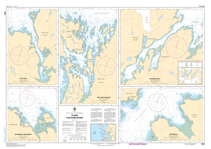
Navigate the intricate approaches to Canada’s northernmost Pacific gateway with the professional authority of the Canadian Hydrographic Service (CHS). Chart 3909 is a specialized "multi-plan" navigational tool, providing the high-resolution detail required to safely enter the vital harbors and sheltered inlets of Chatham Sound.
Chatham Sound is a dynamic marine environment influenced by the massive outflow of the Skeena River and heavy commercial traffic. CHS Chart 3909 provides the "ground-truth" data required for safe pilotage in these high-stakes zones:
Multi-Plan Specialization: Features large-scale inserts for critical maritime locations, including Porpoise Harbour, Port Edward, Metlakatla, and the waters surrounding Ridley Island.
Technical Inshore Navigation: Offers the granular resolution necessary to identify safe leads through narrow tidal channels and past submerged hazards that are often simplified on general-scale coastal maps.
Anchorages & Seafloor Intelligence: Shows precise water depths and the nature of the sea bottom (rock, sand, or mud), vital for selecting secure mooring for vessels awaiting entry to the Port of Prince Rupert.
Hazard & Infrastructure Identification: Explicitly marks drying reefs, industrial wharves, lights, and beacons, providing essential situational awareness for tug and barge operators, commercial fishers, and recreational cruisers.
With the expansion of international shipping and resource development on the North Coast, the reliability of Chart 3909 is more vital than ever. Specifically designed to meet the rigorous requirements of marine navigation, this official CHS chart delivers the accuracy and detail needed to traverse the Chatham Sound region with total confidence.
| Feature | Details |
| Chart Number | 3909 |
| Region | Pacific Coast (Chatham Sound / North Coast BC) |
| Format | Multi-Plan Chart (Multiple large-scale harbor inserts) |
| Publisher | Canadian Hydrographic Service (CHS) |
| Key Coverage | Metlakatla, Porpoise Harbour, Port Edward, Ridley Island |
| Compliance | Meets official carriage requirements for safe marine navigation |