QUESTIONS? CALL OR TEXT! 1 (877) 921-6277 or (403) 266-2241
WE SHIP EVERYWHERE!

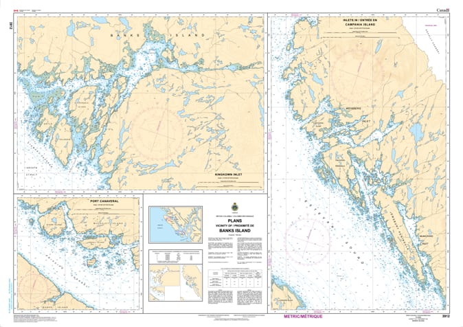
Navigate the rugged and windswept frontier of the North Coast with the professional authority of the Canadian Hydrographic Service (CHS). Chart 3912 is a specialized "multi-plan" navigational tool, providing the high-resolution detail required to safely traverse the technical passages and sheltered harbors surrounding Banks Island.
Banks Island acts as a massive barrier between the open Hecate Strait and the inner Principe Channel. CHS Chart 3912 provides the "ground-truth" data required for safe pilotage in this complex environment:
Multi-Plan Resolution: Unlike broad coastal maps, 3912 features large-scale, high-detail inserts for critical refuge areas and narrow transits, including Larsen Harbour, Calamity Bay, and segments of Otter Passage.
Transition Navigation: Offers the granular resolution necessary to identify safe leads through the rocky shoals and tidal narrows that connect the inner channels to the open sea.
Anchorages & Seafloor Intelligence: Shows precise water depths and the nature of the sea bottom (rock, sand, or shell), vital for selecting secure mooring in a region known for its high-energy weather and tidal shifts.
Hazard & Landmark Identification: Explicitly marks drying reefs, kelp forests, and navigational aids, providing essential situational awareness for commercial fishers, tug and barge operators, and wilderness cruisers.
As a primary resource for mariners seeking the "outside" route or needing to duck into shelter from Hecate Strait, the reliability of Chart 3912 is paramount. Specifically designed to meet the rigorous requirements of marine navigation, this official CHS chart delivers the accuracy and detail needed to explore the wild western edge of the BC mainland with total confidence.
| Feature | Details |
| Chart Number | 3912 |
| Region | Pacific Coast (North Coast BC / Banks Island) |
| Format | Multi-Plan Chart (Harbour and Passage inserts) |
| Publisher | Canadian Hydrographic Service (CHS) |
| Key Coverage | Banks Island, Otter Passage, Larsen Harbour, Calamity Bay |
| Compliance | Meets official carriage requirements for safe marine navigation |