QUESTIONS? CALL OR TEXT! 1 (877) 921-6277 or (403) 266-2241
WE SHIP EVERYWHERE!

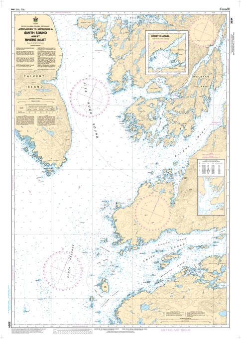
Navigate the transition from the open Pacific to the sheltered deep-water inlets of the Central Coast with the professional authority of the Canadian Hydrographic Service (CHS). Chart 3934 is the definitive 1:40,000 scale "road map" for mariners, providing the high-resolution data required for safe passage through the entrance of Smith Sound and the primary southern approaches to Rivers Inlet.
The waters surrounding Calvert Island and the mouth of Smith Sound are known for their complex currents and significant swell. CHS Chart 3934 provides the "ground-truth" data required for safe pilotage:
Smith Sound & Rivers Inlet Entrance: Features high-resolution bathymetry for the waters between Egg Island and Cranstown Hill, marking the safe leads into these major fjord systems.
Fitz Hugh Sound Southern Link: Detailed mapping of the southern reaches of Fitz Hugh Sound, a vital corridor for vessels transiting the Inside Passage.
Hazard & Rock Identification: Explicitly marks the numerous drying reefs, rocks, and islets that fringe Penrose Island and the exposed outer coast, ensuring situational awareness during heavy weather.
Strategic Navigational Aids: Identifies major lights and beacons, including the critical Egg Island light, providing essential landmarks for vessels making their landfall after crossing Queen Charlotte Sound.
As the primary navigational resource for vessels seeking shelter after rounding Cape Caution, the reliability of Chart 3934 is paramount. Specifically designed to meet the rigorous requirements of marine navigation, this official CHS chart delivers the accuracy and detail needed to navigate the wild western fringe of the BC mainland with total confidence.
| Feature | Details |
| Chart Number | 3934 |
| Region | Pacific Coast (Central Coast BC / Smith Sound) |
| Scale | 1:40,000 |
| Dimensions | 36" x 48" (Standard Paper Size) |
| Publisher | Canadian Hydrographic Service (CHS) |
| Key Coverage | Smith Sound, Rivers Inlet Entrance, Calvert Island, Fitz Hugh Sound |
| Compliance | Meets official carriage requirements for safe marine navigation |