QUESTIONS? CALL OR TEXT! 1 (877) 921-6277 or (403) 266-2241
WE SHIP EVERYWHERE!

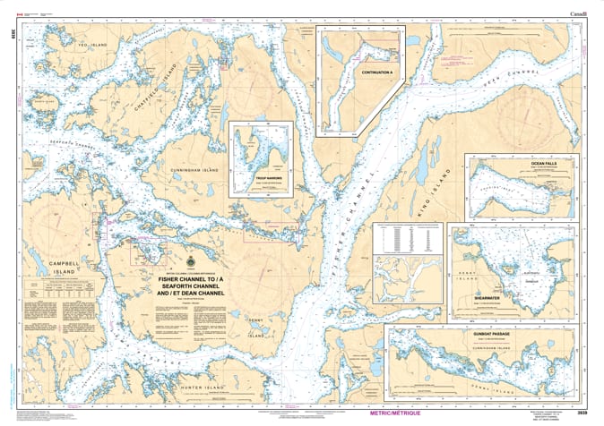
Navigate the complex heart of the British Columbia Mid-Coast with the professional authority of the Canadian Hydrographic Service (CHS). Chart 3939 is a critical 1:40,000 scale navigational tool, providing the high-resolution "ground-truth" data required to safely traverse the high-traffic waters where the Inside Passage meets the deep-water fjords of Dean Channel.
This region is a primary corridor for BC Ferries, commercial tugs, and wilderness cruisers. CHS Chart 3939 provides the specific intelligence needed for safe passage through these technical waters:
The Dean & Fisher Convergence: Features detailed bathymetry for the strategic junction where Dean Channel, Fisher Channel, and Johnson Channel meet—a vital area for vessels heading toward the historic site of Ocean Falls.
Shearwater & Denny Island Access: Offers the granular resolution necessary to safely enter the marine hub of Shearwater, providing safe leads for fuel, supplies, and sheltered moorage.
Technical Inside Passage Detail: Comprehensive coverage of the eastern reaches of Seaforth Channel, including the approaches to the island-studded Gunboat Passage.
Hazard & Landmark Identification: Explicitly marks drying reefs, submerged pinnacles, and the navigational aids required to navigate the area's narrow channels and frequent weather shifts.
As the primary resource for mariners transiting between the Fitz Hugh Sound corridor and the northern reaches of the Great Bear Rainforest, the reliability of Chart 3939 is paramount. Specifically designed to meet the rigorous requirements of marine navigation, this official CHS chart delivers the accuracy and detail needed to explore the BC wilderness with total confidence.
| Feature | Details |
| Chart Number | 3939 |
| Region | Pacific Coast (Central Coast BC) |
| Scale | 1:40,000 |
| Dimensions | Approx. 36" x 48" (Standard Paper Size) |
| Publisher | Canadian Hydrographic Service (CHS) |
| Key Coverage | Fisher Channel, Seaforth Channel, Dean Channel, Shearwater |
| Compliance | Meets official carriage requirements for safe marine navigation |