QUESTIONS? CALL OR TEXT! 1 (877) 921-6277 or (403) 266-2241
WE SHIP EVERYWHERE!

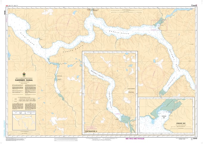
Navigate the majestic and formidable reaches of the North Coast fjords with the professional authority of the Canadian Hydrographic Service (CHS). Chart 3948 is the definitive 1:40,000 scale navigational guide for Gardner Canal, providing the high-resolution data required to safely explore this 90km-long glacial fjord that carves deep into the Coast Mountains.
Gardner Canal is a region of immense scale, featuring vertical granite walls, massive waterfalls, and the industrial significance of the Kemano power project. CHS Chart 3948 provides the "ground-truth" data required for safe pilotage in these deep-water reaches:
Kemano Bay & Industrial Access: Features high-resolution mapping for the approaches to Kemano Bay, providing critical data for vessels supporting the hydroelectric infrastructure and local operations.
Triumph Bay & Alan Reach: Detailed bathymetry for the primary branching arms of the canal, including the stunning Triumph Bay, known for its remote beauty and technical entrances.
The Kitlope Connection: Provides the resolution necessary to navigate the head of the canal near the Kitlope Heritage Conservancy, the world’s largest intact coastal temperate rainforest.
Hazard & Anchorage Intelligence: Explicitly marks drying reefs, silt bars at river mouths (such as the Kowesas River), and seafloor composition, vital for identifying rare secure anchorages in this exceptionally deep fjord.
As the primary navigational resource for industrial vessels, scientific researchers, and wilderness cruisers, the reliability of Chart 3948 is paramount. Specifically designed to meet the rigorous requirements of marine navigation, this official CHS chart delivers the accuracy and detail needed to navigate the northern fjordlands with total confidence.
| Feature | Details |
| Chart Number | 3948 |
| Region | Pacific Coast (North Coast BC / Gardner Canal) |
| Scale | 1:40,000 |
| Dimensions | Approx. 36" x 48" (Standard Paper Size) |
| Publisher | Canadian Hydrographic Service (CHS) |
| Key Coverage | Gardner Canal, Kemano Bay, Triumph Bay, Devastation Channel |
| Compliance | Meets official carriage requirements for safe marine navigation |