QUESTIONS? CALL OR TEXT! 1 (877) 921-6277 or (403) 266-2241
WE SHIP EVERYWHERE!

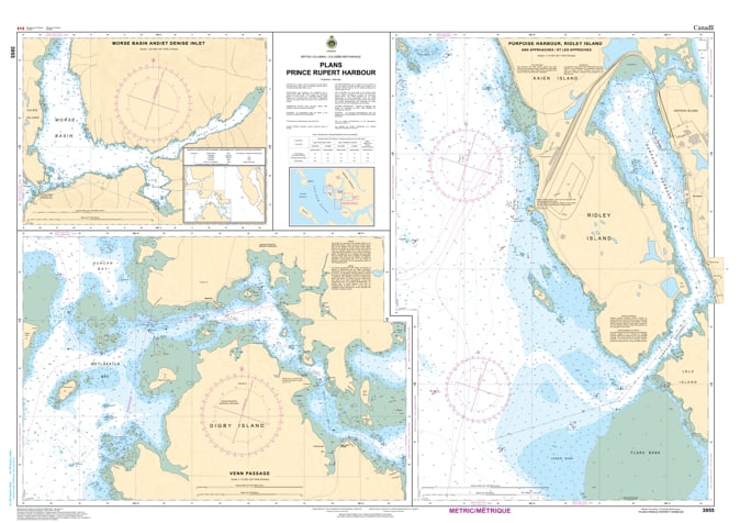
Navigate the gateway to the Pacific with the professional authority of the Canadian Hydrographic Service (CHS). Chart 3955 is the definitive 1:20,000 scale navigational guide for Prince Rupert Harbour, providing the extreme high-resolution data required for safe passage through one of the most strategic maritime hubs in North America.
As the primary resource for pilots guiding massive container ships and local mariners navigating the North Coast, CHS Chart 3955 provides the "ground-truth" data required for safe operations:
Terminal & Infrastructure Detail: Features high-resolution mapping of the Fairview Container Terminal, Ridley Island coal and grain facilities, and the various commercial wharves lining the waterfront.
Digby Island & Airport Transit: Detailed bathymetry for the waters surrounding Digby Island, including the ferry routes and the technical navigation required for the approaches to the Prince Rupert Airport.
Metlakatla & Tuck Inlet: Provides the resolution necessary to navigate the cultural and ecological waters toward Metlakatla and the sheltered reaches of Tuck Inlet.
Anchorage & Mooring Intelligence: Explicitly marks designated deep-water anchorages, mooring buoys, and undersea cables, vital for situational awareness in this high-density traffic zone.
Whether you are a professional mariner handling international freight or a local fisher navigating the Skeena River delta, the reliability of Chart 3955 is paramount. Specifically designed to meet the rigorous requirements of marine navigation, this official CHS chart delivers the accuracy and detail needed to move through the Prince Rupert Harbour complex with total confidence.
| Feature | Details |
| Chart Number | 3955 |
| Region | Pacific Coast (North Coast BC / Prince Rupert) |
| Scale | 1:20,000 |
| Dimensions | Approx. 36" x 48" (Standard Paper Size) |
| Publisher | Canadian Hydrographic Service (CHS) |
| Key Coverage | Prince Rupert Harbour, Fairview Terminal, Ridley Island, Digby Island |
| Compliance | Meets official carriage requirements for safe marine navigation |