QUESTIONS? CALL OR TEXT! 1 (877) 921-6277 or (403) 266-2241
WE SHIP EVERYWHERE!

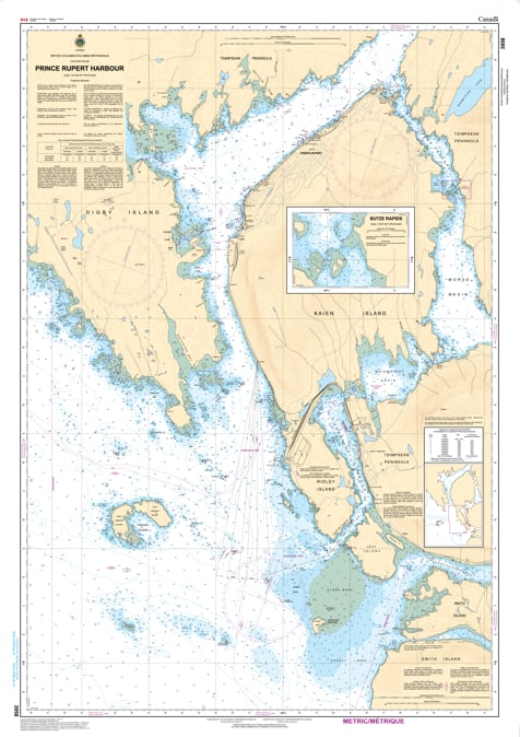
Navigate the busiest and most sheltered reaches of the North Coast with the professional authority of the Canadian Hydrographic Service (CHS). Chart 3958 is a specialized, high-scale navigational tool providing the "micro-level" detail required for safe transit and docking within the Prince Rupert Harbour complex and its northern extensions.
This chart is the gold standard for mariners who require exact bathymetry and infrastructure data within the harbour's inner limits. CHS Chart 3958 provides the specific intelligence needed for safe operations:
Waterfront & Terminal Detail: Features extreme resolution for the Prince Rupert waterfront, including private marinas, commercial wharves, and the critical approach paths to major shipping terminals.
Tuck Inlet & Morse Basin: Provides the definitive mapping for Tuck Inlet and Morse Basin, areas often frequented by local traffic and those seeking sheltered waters away from the main shipping channels.
Infrastructure & Hazard Identification: Explicitly details pier footprints, mooring dolphins, submarine cables, and the exact positioning of harbour lights—essential for night navigation and docking in heavy weather.
Tidal & Current Awareness: Offers granular depth data vital for managing the significant tidal ranges and currents that define the upper reaches of the harbour.
As the primary navigational resource for harbour pilots, tug operators, and recreational boaters moored in the city's marinas, the reliability of Chart 3958 is paramount. Specifically designed to meet the rigorous requirements of marine navigation, this official CHS chart delivers the accuracy needed to explore every corner of Prince Rupert’s inner waters with total confidence.
| Feature | Details |
| Chart Number | 3958 |
| Region | Pacific Coast (North Coast BC / Prince Rupert) |
| Scale | 1:20,000 |
| Dimensions | Approx. 36" x 45" (Standard Paper Size) |
| Publisher | Canadian Hydrographic Service (CHS) |
| Key Coverage | Inner Prince Rupert Harbour, Tuck Inlet, Morse Basin, City Waterfront |
| Compliance | Meets official carriage requirements for safe marine navigation |