QUESTIONS? CALL OR TEXT! 1 (877) 921-6277 or (403) 266-2241
WE SHIP EVERYWHERE!

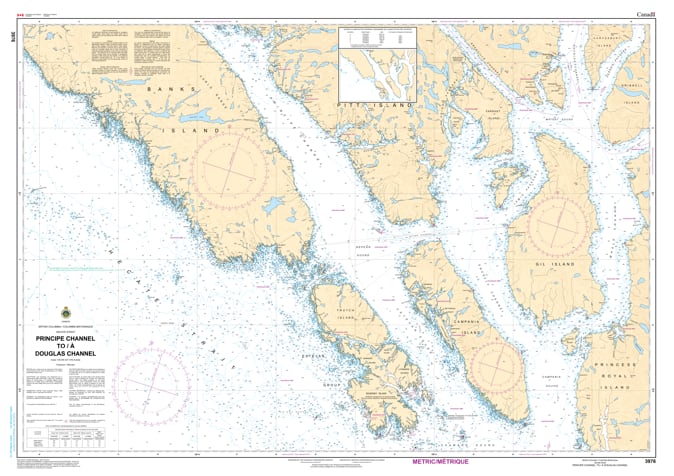
Navigate the booming industrial corridor of British Columbia’s North Coast with the professional precision of the Canadian Hydrographic Service (CHS). Chart 3976 is the definitive "road map" for mariners transiting from the open reaches of the Principe Channel into the deep glacial fjords of the Douglas Channel, serving as the primary route to the Port of Kitimat.
As Kitimat transforms into a global energy hub, Douglas Channel has become one of Canada's most vital shipping arteries. CHS Chart 3976 provides the high-fidelity data required to manage this increased traffic safely:
Coastal Scale Detail (1:80,000): Offers extensive coverage of the primary shipping lanes with sufficient inshore detail for landfall sightings and channel transit.
Essential for Large Vessels: Provides precise bathymetry and sea bottom characteristics—critical for deep-draft LNG tankers, aluminum ore carriers, and the fleet of escort tugs required for safe passage.
Intricate Waterway Navigation: Clearly marks the lateral buoys, range lights, and coastal elevations of the Kitimat Arm, helping mariners navigate the steep-walled fjords and avoid submerged hazards.
Inside Passage Link: Serves as a key component of the Inside Passage route planning, connecting the coastal archipelago to the mainland’s industrial heart.
With international vessel traffic to the North Coast projected to grow significantly, the role of official CHS charts has never been more vital. Whether you are a ship's pilot guiding a container vessel or a recreational explorer venturing into the remote fjords of the Great Bear Rainforest, Chart 3976 provides the "ground-truth" data required to ensure the safety of your vessel and crew.
| Feature | Details |
| Chart Number | 3976 |
| Region | Pacific Coast - North Coast (Principe & Douglas Channels) |
| Scale | 1:80,000 (Coastal Scale) |
| Publisher | Canadian Hydrographic Service (CHS) |
| Key Coverage | Principe Channel, Douglas Channel, Kitimat Arm, Nepean Sound |
| Carriage Compliance | Meets Canada Shipping Act & SOLAS Chapter V requirements |