QUESTIONS? CALL OR TEXT! 1 (877) 921-6277 or (403) 266-2241
WE SHIP EVERYWHERE!

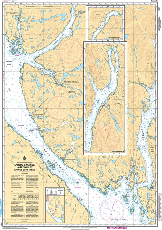
Navigate the intricate and pristine waterways of the British Columbia Central Coast with the professional authority of the Canadian Hydrographic Service (CHS). Chart 3981 is the definitive 1:40,000 scale navigational guide for Laredo Channel and the deep, branching reaches of Laredo Inlet, providing the high-resolution data required for safe transit through the heart of the Great Bear Rainforest.
Laredo Channel is a vital sheltered artery for vessels moving north or south, offering protection from the open Hecate Strait. CHS Chart 3981 provides the "ground-truth" data required for safe pilotage in these technical waters:
Laredo Channel Mainline: Features high-resolution bathymetry for the primary corridor between Aristazabal Island and Princess Royal Island, essential for Inside Passage navigation.
Laredo Inlet Exploration: Detailed mapping for the long, narrow reaches of Laredo Inlet, including branching arms like Kent Inlet and Bayly Bay, providing the resolution necessary for safe anchorage and exploration.
Meyers Passage & Swindle Island: Provides the strategic data required to navigate the southern approaches to Meyers Passage, a popular shortcut for cruisers seeking the most sheltered route possible.
Hazard & Landmark Intelligence: Explicitly marks drying reefs, kelp forests, and prominent navigational aids required for situational awareness in an area defined by steep fjord walls and complex currents.
As the primary navigational resource for eco-tour vessels, commercial fishers, and long-range cruisers, the reliability of Chart 3981 is paramount. Specifically designed to meet the rigorous requirements of marine navigation, this official CHS chart delivers the accuracy and detail needed to explore the Laredo fjord systems with total confidence.
| Feature | Details |
| Chart Number | 3981 |
| Region | Pacific Coast (Central Coast BC / Laredo Channel) |
| Scale | 1:40,000 |
| Dimensions | Approx. 36" x 49" (Standard Large Format) |
| Publisher | Canadian Hydrographic Service (CHS) |
| Key Coverage | Laredo Channel, Laredo Inlet, Aristazabal Island, Princess Royal Island |
| Compliance | Meets official carriage requirements for safe marine navigation |