QUESTIONS? CALL OR TEXT! 1 (877) 921-6277 or (403) 266-2241
WE SHIP EVERYWHERE!

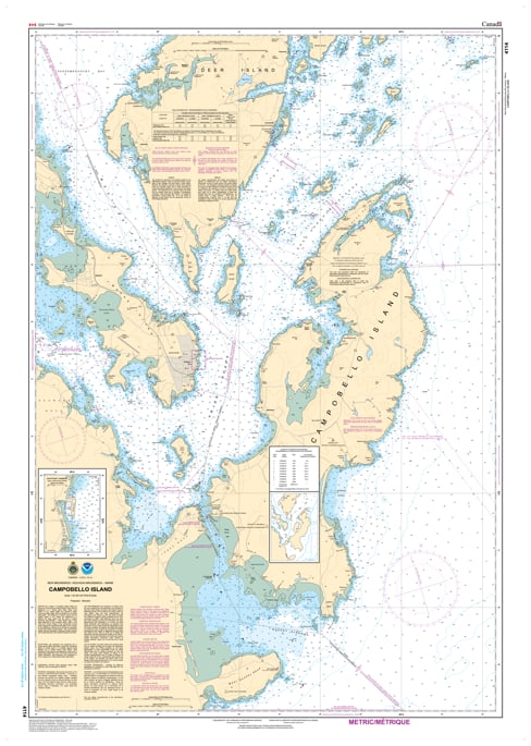
Navigate the dramatic tides and historic shores of the Fundy Isles with the 4114 - Campobello Island Nautical Chart. This professional-grade hydrographic reference is the definitive guide for one of the most technically challenging and beautiful maritime regions in North America. Covering the entirety of Campobello Island and the strategic approaches to Passamaquoddy Bay, Chart 4114 provides the "ground-truth" data required to safely manage the powerful currents of the Lubec Narrows and the deep waters of the Western Passage.
Produced to the rigorous standards of the Canadian Hydrographic Service (CHS), Chart 4114 delivers comprehensive information for this international crossroad:
The Lubec Narrows & International Bridge: Features high-resolution mapping for the narrow channel between Lubec, Maine, and Campobello Island, including critical depth soundings and bridge clearances.
Harbor & Anchorage Detail: Detailed data for the waters surrounding Welshpool, Wilson's Beach, and the approaches to Eastport, Maine.
Iconic Landmarks: Provides clear positioning for the Head Harbour (East Quoddy) Lightstation, a vital waypoint for mariners entering the bay.
Complex Currents & Bathymetry: Offers accurate soundings and seabed characteristics for the deep trenches and rocky ledges that define the Bay of Fundy entrance.
Beyond the bridge, this chart serves as a sophisticated piece of maritime history and art for those with a connection to the Atlantic Provinces or Downeast Maine.
Official Technical Aesthetic: Showcases the intricate line work, sounding density, and maritime symbols that define professional Canadian hydrography.
High-Definition Print: Every sounding and contour line is rendered with sharp clarity, making it ideal for route planning, whale watching excursions, or professional framing.
The Perfect Island Gift: An ideal memento for residents of Charlotte County, visitors to the Roosevelt Campobello International Park, or any sailor who has conquered the Fundy tides.
| Feature | Details |
| Chart Number | 4114 |
| Location | Campobello Island, New Brunswick / Maine, USA |
| Scale | 1:25,000 |
| Key Areas | Lubec Narrows, Eastport, Welshpool, Head Harbour |
| Data Type | Hydrographic (Depths, Tides, International Boundary) |
| Publisher | Canadian Hydrographic Service (CHS) Standards |