QUESTIONS? CALL OR TEXT! 1 (877) 921-6277 or (403) 266-2241
WE SHIP EVERYWHERE!

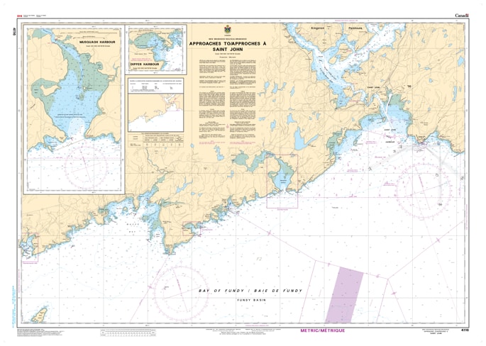
Command your entrance into one of Canada’s most vital industrial ports with the 4116 - Approaches to/à Saint John Nautical Chart. This professional-grade hydrographic reference is the definitive tool for navigating the technical waters of the Bay of Fundy as they converge at Saint John. Covering the coastal waters from Musquash Harbour to Cape Spencer, Chart 4116 provides the "ground-truth" data required for safe passage through high-traffic VTS (Vessel Traffic Services) zones and powerful tidal currents.
Produced to the rigorous standards of the Canadian Hydrographic Service (CHS), Chart 4116 delivers comprehensive information for this major maritime corridor:
Primary Shipping Channels: Features high-resolution mapping of the inbound and outbound traffic separation schemes (TSS) essential for commercial tankers, container ships, and cruise liners.
Tidal Dynamics & Soundings: Provides accurate bathymetry and depth soundings that account for the massive tidal ranges of the Bay of Fundy, including critical data for Partridge Island and the Main Channel.
Regional Coastal Detail: Includes detailed mapping of Musquash Harbour, Lorneville, and the rugged coastline leading to the Mispec Point oil terminals.
Navigational Aids: Clearly marks the light characteristics, buoys, and radar reflectors (RACON) used by pilots and mariners to maintain safe positioning in foggy or nighttime conditions.
Beyond the bridge, this chart is a sophisticated piece of maritime history and art for those with a connection to Saint John or the Southern New Brunswick coast.
Official Technical Aesthetic: Showcases the intricate line work, sounding density, and maritime symbols that define professional Canadian hydrography.
High-Definition Print: Every sounding and contour line is rendered with sharp clarity, making it ideal for route planning, search and rescue coordination, or professional framing.
The Ultimate Saint John Gift: An ideal memento for harbor pilots, tugboat operators, or anyone who calls the Bay of Fundy their home waters.
| Feature | Details |
| Chart Number | 4116 |
| Location | Approaches to Saint John, New Brunswick |
| Scale | 1:50,000 |
| Key Areas | Saint John Harbour, Musquash Harbour, Cape Spencer, Partridge Island |
| Data Type | Hydrographic (Depths, TSS Lanes, Navigational Aids) |
| Publisher | Canadian Hydrographic Service (CHS) Standards |