QUESTIONS? CALL OR TEXT! 1 (877) 921-6277 or (403) 266-2241
WE SHIP EVERYWHERE!

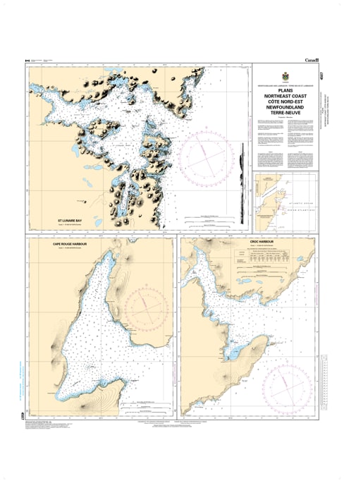
Navigate the rugged and intricate "outports" of Atlantic Canada with the professional authority of the Canadian Hydrographic Service (CHS). Chart 4507 is a specialized "Plans" chart, providing high-resolution, large-scale views of critical harbors and passages along the Northeast Coast of Newfoundland.
The Northeast Coast is famous for its "sunken hills"—a complex landscape of deep fjords and hidden shoals. While standard coastal charts show the big picture, Chart 4507 provides the granular detail needed for:
Harbor-Specific Insets: Large-scale plans that reveal the exact layout of wharves, jetties, and breakwaters in key NE coast communities.
Complex Bathymetry: Highly accurate depth soundings that identify safe approach channels through the rocky "tickles" and reaches of Notre Dame Bay and surrounding areas.
Seabed Nature & Anchoring: Detailed information on the nature of the sea bottom (mud, rock, or kelp), vital for ensuring a secure set in exposed Atlantic conditions.
Coastal Hazards: Precise marking of "wash rocks," submerged pinnacles, and local aids to navigation that are essential for fog-bound or night-time arrivals.
As the development of ocean resources and boutique Arctic-style tourism expands in Newfoundland and Labrador, the role of Chart 4507 is more vital than ever. Whether you are a commercial fisherman, a captain of a research vessel, or a recreational cruiser exploring the "rock," this chart provides the "ground-truth" data required for safe, port-to-port navigation.
| Feature | Details |
| Chart Number | 4507 |
| Region | Northeast Coast of Newfoundland (Atlantic Canada) |
| Type | Plans (Large-Scale Harbor Insets) |
| Publisher | Canadian Hydrographic Service (CHS) |
| Key Coverage | Selected Harbors and Approaches, NE Coast NL |
| Vessel Compliance | Meets official carriage requirements for safe navigation |