QUESTIONS? CALL OR TEXT! 1 (877) 921-6277 or (403) 266-2241
WE SHIP EVERYWHERE!

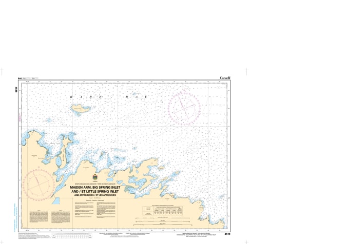
Navigate the secluded and deeply carved fjords of the Great Northern Peninsula with the high-resolution precision of CHS Nautical Chart 4519. This large-scale chart provides specialized coverage of Maiden Arm, Big Spring Inlet, and Little Spring Inlet, situated on the rugged eastern coast of Newfoundland within the broader Hare Bay region. These inlets are characterized by steep-to shorelines, dramatic limestone cliffs, and remote, pristine waters that offer critical shelter from the volatile North Atlantic.
Chart 4519 features detailed hydrographic data for these narrow "arms," which are essential for mariners seeking refuge or exploring the wilderness coastline. It provides critical mapping for the intricate entrances and deep-water basins of Maiden Arm and the twin Spring Inlets. Whether you are a commercial fisher operating in the deep troughs of the Northern Peninsula, a recreational sailor on a northern expedition, or a researcher studying the unique sub-arctic marine ecosystems of Hare Bay, this official Canadian Hydrographic Service chart delivers the soundings, navigational aids, and shoreline topography necessary for safe pilotage in these untamed waters.
Key Features include:
Detailed Inlet Mapping: Large-scale coverage of Maiden Arm and both Big and Little Spring Inlets, including their inner reaches and hidden coves.
Hydrographic Accuracy: Features high-density depth soundings and seabed composition essential for anchoring in these deep, rock-bound basins.
Navigation-Critical Infrastructure: Clearly identifies remote coastal beacons, daymarks, and the hazardous "tickles" connecting the inlets to the open bay.
Safety & Hazard Identification: Highlights the "Spring Island" shoals, submerged rocks at the arm entrances, and the steep underwater ledges typical of the Long Range Mountains transition.
Professional Grade: Produced to the rigorous standards of the Canadian Hydrographic Service (CHS) for professional navigation, maritime safety, and GIS spatial analysis.