QUESTIONS? CALL OR TEXT! 1 (877) 921-6277 or (403) 266-2241
WE SHIP EVERYWHERE!

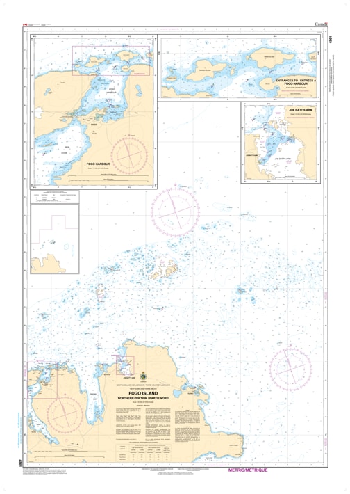
Navigate the legendary and complex waters of Newfoundland's largest offshore island with the professional precision of the Canadian Hydrographic Service (CHS). Chart 4861 is the definitive navigational tool for the Northern Portion of Fogo Island, providing the intricate detail required for safe passage through the rocky shoals and deep channels of this North Atlantic gem.
Fogo Island sits in the heart of "Iceberg Alley," where dynamic currents and submerged hazards demand the highest level of cartographic accuracy. CHS Chart 4861 is specifically engineered to handle these conditions:
Detailed Outport Bathymetry: Provides the granular depth soundings necessary to safely enter iconic harbors such as Fogo Harbour, Joe Batt's Arm, and Tilting.
Navigation through Shoals: Clearly marks the "sunken rocks" and breakers that define the northern coast, essential for both the local fishing fleet and visiting expedition cruisers.
Coastal Elevations & Visual Landmarks: Displays the unique topographical features of the island's coastline, assisting in visual pilotage when navigating in the low-visibility fog typical of the Newfoundland coast.
Seabed Characteristics: Vital information for securing an anchor in the various coves and reaches when waiting out Atlantic gales.
With the increasing global interest in Fogo Island's unique culture and geography, the role of Chart 4861 is more vital than ever. Whether you are a captain of a fishing vessel, a tour operator for iceberg excursions, or a recreational sailor, this official CHS chart provides the "ground-truth" data required for safe, port-to-port navigation.
| Feature | Details |
| Chart Number | 4861 |
| Region | Fogo Island (Northern Portion), Newfoundland |
| Publisher | Canadian Hydrographic Service (CHS) |
| Key Coverage | Fogo Harbour, Joe Batt's Arm, Tilting, Round Head |
| Scale | Large-scale navigational detail for northern approaches |
| Vessel Compliance | Meets official carriage requirements for safe marine navigation |