QUESTIONS? CALL OR TEXT! 1 (877) 921-6277 or (403) 266-2241
WE SHIP EVERYWHERE!

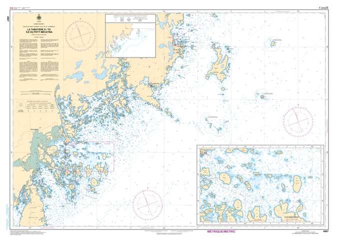
Navigate the wild and majestic waters of Quebec's Lower North Shore with the professional precision of the Canadian Hydrographic Service (CHS). Chart 4967 is the definitive navigational authority for the coastal stretch between the fishing hub of La Tabatière and the historic shores of Île du Petit Mécatina.
The Basse-Côte-Nord is a region defined by its complex island chains, rocky "tickles," and deep glacial fjords. CHS Chart 4967 provides the high-fidelity data required for safe passage in this isolated maritime environment:
Large-Scale Coastal Detail: Features precise depth soundings and seafloor characteristics—essential for navigating the approach to La Tabatière, home to one of the largest fish processing plants on the coast.
Intricate Island Navigation: Provides the granular detail needed to navigate the passage between Île du Petit Mécatina and the mainland, identifying safe channels through the Gros-Mécatina archipelago.
Hazard & Shoal Identification: Clearly marks the submerged rocks, reefs, and local aids to navigation that are critical for vessels operating in the frequent fog and variable weather of the Gulf of St. Lawrence.
Safe Anchorage & Landfall: Identifies the nature of the sea bottom and coastal elevations, helping mariners find shelter in remote coves and orient themselves against the rugged shoreline.
With the growth of expedition tourism and the continued importance of the coastal supply chain, the role of Chart 4967 is more vital than ever. Whether you are a captain of a northern supply vessel, a commercial crab fisherman, or a wilderness sailor, this official CHS chart provides the "ground-truth" data required to ensure the safety of your vessel and crew.
| Feature | Details |
| Chart Number | 4967 |
| Region | Quebec - Basse-Côte-Nord (Lower North Shore) |
| Publisher | Canadian Hydrographic Service (CHS) |
| Key Coverage | La Tabatière, Île du Petit Mécatina, Gros-Mécatina |
| Scale | Coastal scale with detailed harbor and passage data |
| Application | Commercial fishing, supply logistics, and expedition cruising |