QUESTIONS? CALL OR TEXT! 1 (877) 921-6277 or (403) 266-2241
WE SHIP EVERYWHERE!

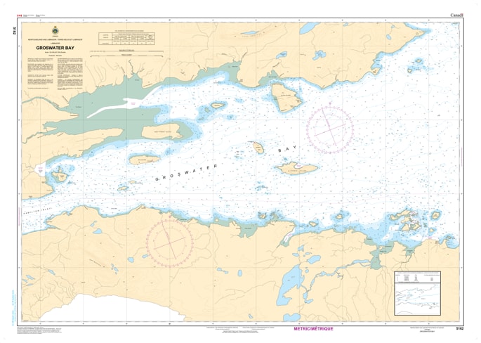
Navigate the deep-water approaches of the Labrador coast with the professional authority of the Canadian Hydrographic Service (CHS). Chart 5162 is the indispensable "road map" for mariners entering Groswater Bay, the primary maritime entrance to Hamilton Inlet and the port of Happy Valley-Goose Bay.
The coast of Labrador is famous for its complex bathymetry and shifting ice conditions. CHS Chart 5162 is specifically engineered to meet the stringent requirements of sub-arctic marine navigation by providing:
Hydrographic Depth Soundings: Critical for the safe passage of commercial supply ships, fishing vessels, and coastal ferries through the deep channels of the bay.
Detailed Shoreline Configuration: Shows the precise elevations and characteristics of the rugged Labrador coast, assisting in radar navigation and visual pilotage.
Seabed Nature & Composition: Essential data for secure anchoring in the exposed reaches of the bay or when seeking shelter in the lee of local islands.
Navigational Hazards & Aids: Clearly identifies underwater pinnacles, shoals, and all official aids to navigation, including lights and markers vital for transit in low-visibility conditions.
As commercial shipping and resource development in the North expand, the role of official CHS charts is more vital than ever. Whether you are a captain of a northern supply vessel, a local fisherman, or an adventure cruiser exploring the Rigolet area, Chart 5162 provides the "ground-truth" data required for safe and efficient passage.
| Feature | Details |
| Chart Number | 5162 |
| Region | Groswater Bay, Labrador (Entrance to Hamilton Inlet) |
| Publisher | Canadian Hydrographic Service (CHS) |
| Scale | Professional Navigational Scale |
| Key Coverage | Groswater Bay, approaches to Rigolet and Hamilton Inlet |
| Application | Commercial shipping, fishing, and resource exploration |