QUESTIONS? CALL OR TEXT! 1 (877) 921-6277 or (403) 266-2241
WE SHIP EVERYWHERE!

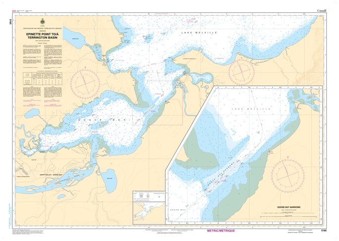
Ensure a safe arrival at the heart of Labrador’s maritime hub with the 5165 - Epinette Point to Terrington Basin Nautical Chart. Published by the Canadian Hydrographic Service (CHS), this chart provides the high-resolution data required for the delicate transition from the open waters of Lake Melville into the restricted commercial docks of Happy Valley-Goose Bay.
The approach to Terrington Basin is characterized by shallow sand flats and the birds-foot delta of the Goose River. Chart 5165 is the "road map" for these challenging final miles, offering:
High-Detail Bathymetry: Essential for deep-draft supply ships and tankers managing the 21-foot bar and restricted channels leading into the basin.
Current & Tidal Data: Critical for timing entries through the shifting sands where land drainage meets the tidal influence of Hamilton Inlet.
Dockage & Basin Layout: Provides clear configurations of the Terrington Basin shoreline, essential for final piloting and berthing at the commercial wharves.
Hazard & Aid Markers: Identifies the precise locations of buoys and beacons that define the narrow navigable channel amidst the silt deposits.
Under the Canada Shipping Act, carrying official CHS charts is a legal requirement for most vessels operating in these waters. Whether you are coordinating northern supply logistics or exploring the scenic inlets of the Goose Bay area, Chart 5165 is your primary defense against grounding in one of Labrador’s most dynamic sediment environments.
| Feature | Details |
| Chart Number | 5165 |
| Region | Epinette Point to Terrington Basin, Labrador |
| Scale | 1:60,000 |
| Primary Port | Happy Valley-Goose Bay |
| Key Features | Goose River Delta, Terrington Basin Docks, Lake Melville Western End |