QUESTIONS? CALL OR TEXT! 1 (877) 921-6277 or (403) 266-2241
WE SHIP EVERYWHERE!

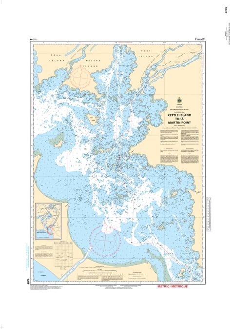
Navigate the northern waters of Lake Winnipeg with the professional-grade 6259 Kettle Island to Martin Point nautical chart. Published by the Canadian Hydrographic Service (CHS), this official navigational product is a high-resolution "road map" designed to guide mariners safely through the critical northern corridors of Manitoba’s inland waterways.
As commercial shipping, fishing activity, and recreational boating continue to develop in this region, the precision of a CHS chart is more vital than ever. This chart is meticulously engineered to meet the stringent requirements of marine navigation, featuring:
Bathymetry & Depths: Detailed water depth soundings to ensure safe keel clearance and prevent grounding in northern lake conditions.
Submarine Topography: Vital information regarding the nature of the sea or lake bottom for secure anchoring.
Coastal Configuration: Accurate mapping of shorelines, elevations, and prominent coastal characteristics from Kettle Island to Martin Point.
Navigational Hazards & Aids: Clear identification of underwater dangers, rocks, buoys, lights, and beacons to ensure a safe port-to-port journey.
Whether you are a commercial vessel captain or a recreational explorer, this official CHS chart delivers the technical accuracy and visual clarity required for safe and successful navigation in the northern basin.