QUESTIONS? CALL OR TEXT! 1 (877) 921-6277 or (403) 266-2241
WE SHIP EVERYWHERE!

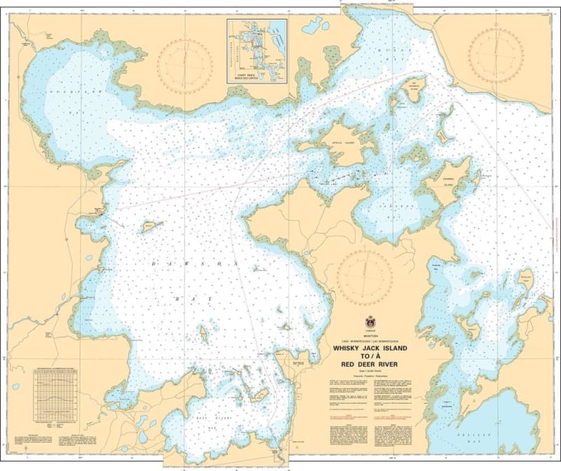
Navigate the northernmost reaches of Lake Winnipegosis with the high-precision 6274 Whiskey Jack Island to Red Deer River nautical chart. Published by the Canadian Hydrographic Service (CHS), this official navigational tool is the primary "road map" for mariners traversing the complex transition between the open lake and the Red Deer River mouth.
As commercial fishing and regional transit remain vital to the Manitoba interior, the accuracy of CHS data is essential for safe, port-to-port passage. This chart is meticulously designed to meet the rigorous requirements of marine navigation, featuring:
Detailed Bathymetry: Accurate water depth soundings to ensure safe keel clearance in the northern basin and river approaches.
Submarine Topography: Vital information regarding the nature of the lake bottom for secure anchoring and hazard avoidance.
Coastal Characteristics: Precise mapping of shorelines, elevations, and the configurations of the northern inlets and river delta.
Navigational Hazards & Aids: Clear identification of rocks, shoals, underwater dangers, buoys, lights, and beacons.
Whether you are a professional vessel operator or a recreational boater exploring the unique geography of Northern Manitoba, this official CHS chart provides the technical accuracy and visual clarity required for a safe and successful voyage.