QUESTIONS? CALL OR TEXT! 1 (877) 921-6277 or (403) 266-2241
WE SHIP EVERYWHERE!

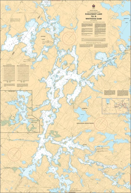
Navigate the technical and scenic waters of the Winnipeg River system with the 6285 Eaglenest Lake to Whitedog Dam nautical chart. Published by the Canadian Hydrographic Service (CHS), this official navigational tool is the essential "road map" for mariners moving through this critical corridor in Northwestern Ontario.
Covering the stretch from the expansive Eaglenest Lake to the significant infrastructure of the Whitedog Dam, this chart is vital for understanding the water fluctuations and hazards common to river navigation. It is specifically designed to meet rigorous marine standards, providing:
Detailed Bathymetry: Accurate water depth soundings to ensure safe passage through river channels and lake transitions.
Submarine Topography: Essential data on the nature of the river and lake bottom for secure anchoring.
Coastal Characteristics: Precise mapping of the rugged Canadian Shield shorelines, islands, and elevations.
Navigational Hazards & Aids: Clear identification of rocks, rapids, underwater obstructions, buoys, and markers necessary for navigating near the Whitedog Falls and Dam area.
Whether you are a local resident, a commercial operator, or a recreational boater exploring the Winnipeg River, this official CHS chart provides the professional-grade accuracy and visual clarity required for a safe and successful voyage.