QUESTIONS? CALL OR TEXT! 1 (877) 921-6277 or (403) 266-2241
WE SHIP EVERYWHERE!

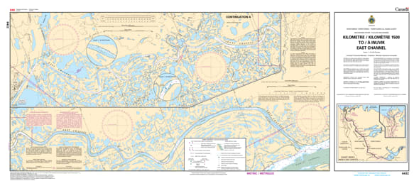
Navigate the complex and beautiful labyrinth of the Mackenzie Delta with the 6432 - Kilometer 1500 to/à Inuvik (East Channel) Nautical Chart. This professional-grade hydrographic reference is the definitive guide for the final 50+ kilometres of the Mackenzie River system. Covering the East Channel from Kilometre 1500 directly into the port of Inuvik, Chart 6432 provides the "ground-truth" data required for safe transit through one of the most dynamic river deltas in the world.
Produced to the rigorous standards of the Canadian Hydrographic Service (CHS), Chart 6432 delivers essential information for northern mariners:
The Inuvik Approach: High-resolution mapping of the East Channel, providing detailed soundings and channel markers critical for the seasonal arrival of supply barges and research vessels.
Inuvik Waterfront Detail: Comprehensive data for the Inuvik docks and public wharves, ensuring safe berthing in the town’s industrious harbor.
Complex Delta Navigation: Features accurate tracking of the winding channel and shifting silt banks characteristic of the Mackenzie Delta, where precise navigation is the difference between a successful voyage and running aground.
Navigational Aids & Landmarks: Clearly marks the buoys, beacons, and local landmarks used by river pilots to navigate the low-profile landscape of the high Arctic.
Beyond the wheelhouse, this chart serves as a sophisticated piece of geographic history for those with a connection to the Beaufort Delta region.
Official Technical Aesthetic: Showcases the intricate line work, sounding density, and specialized river symbols that define professional Canadian inland hydrography.
High-Definition Print: Every depth contour, sandbar, and channel marker is rendered with sharp clarity, making it ideal for route planning, environmental research, or professional framing.
The Ultimate Northern Gift: An ideal memento for river pilots, Delta residents, and explorers who have journeyed to the end of the Dempster Highway and beyond.
| Feature | Details |
| Chart Number | 6432 |
| Location | Mackenzie River Delta (East Channel), NWT |
| River Reach | KM 1500 to Inuvik |
| Key Areas | Inuvik, East Channel, Mackenzie Delta |
| Data Type | Hydrographic (River Depths, Channel Tracks, Harbor Info) |
| Publisher | Canadian Hydrographic Service (CHS) Standards |