QUESTIONS? CALL OR TEXT! 1 (877) 921-6277 or (403) 266-2241
WE SHIP EVERYWHERE!

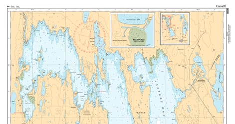
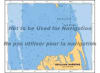
Navigate the expansive northern basin of Manitoba’s inland sea with the 6505 Lake Manitoba (Northern Portion) nautical chart. Published by the Canadian Hydrographic Service (CHS), this official navigational product serves as the definitive "road map" for mariners, commercial fishers, and northern explorers.
This chart covers the northernmost reaches of Lake Manitoba, providing the high-fidelity data necessary to traverse the region between the central narrows and the Fairford River. Given the lake's unique hydrography and varying water levels, the 6506 chart is an essential safety tool, offering critical technical details:
Detailed Bathymetry: Accurate water depth soundings and contour lines designed to help mariners navigate the basin's shallow-water profile safely.
Submarine Topography: Comprehensive bottom-type information to assist with secure anchoring and the identification of submerged hazards.
Coastal Characteristics: High-resolution mapping of the rugged northern shorelines, intricate bays, and coastal elevations unique to the Interlake region.
Navigational Hazards & Aids: Precise identification of shoals, rocky reefs, and underwater obstructions, alongside the exact location of buoys, beacons, and lights.
Modern Geospatial Standards: Produced using the North American Datum 1983 (NAD83), ensuring full compatibility with contemporary GPS and electronic charting systems.
Whether you are a commercial operator supporting local industries or a recreational boater exploring the remote northern waters, this official CHS chart provides the professional-grade accuracy and visual clarity required for a safe and successful voyage.