QUESTIONS? CALL OR TEXT! 1 (877) 921-6277 or (403) 266-2241
WE SHIP EVERYWHERE!

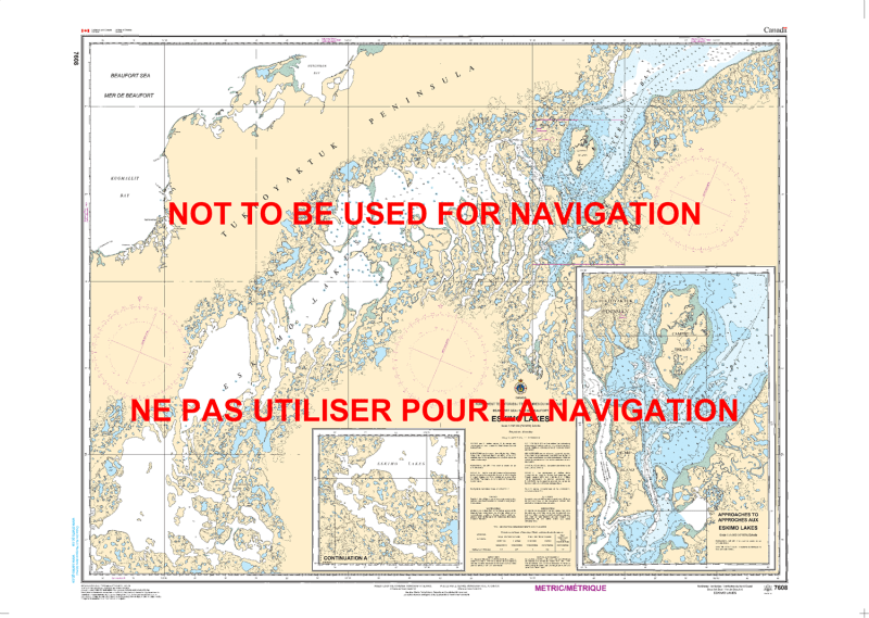
Navigate the complex and sensitive tidal waters of the Mackenzie Delta region with the 7608 Eskimo Lakes nautical chart. Published by the Canadian Hydrographic Service (CHS), this official navigational product is the essential "road map" for mariners, researchers, and traditional land users exploring the Eskimo Lakes (Husky Lakes) in the Northwest Territories.
This region is characterized by an intricate series of brackish basins and narrow "fingers" that connect to the Beaufort Sea via the Liverpool Bay. Because of the unique hydrography and varying depths caused by tidal influence and seasonal runoff, the 7608 chart is a critical safety tool. It provides specialized technical details, including:
High-Resolution Bathymetry: Precise water depth soundings tailored for the shallow and technical channels of the Husky Lakes system.
Submarine Topography: Vital information on the nature of the lake and seabed to assist with secure anchoring and identifying submerged hazards in a shifting environment.
Coastal Geomorphology: Accurate mapping of the delicate tundra shorelines, islands, and narrow passages that define this Arctic watershed.
Navigational Hazards & Aids: Detailed identification of shoals, rocks, and underwater obstructions, alongside the location of any established beacons or markers.
Geospatial Standards: Produced using the North American Datum 1983 (NAD83), allowing for seamless integration with modern satellite-based GPS and chartplotters.
Whether you are conducting environmental research, navigating for traditional harvesting, or exploring the remote Arctic coast, this official CHS chart delivers the technical accuracy and visual clarity required for a safe voyage in one of Canada’s most northern ecosystems.