QUESTIONS? CALL OR TEXT! 1 (877) 921-6277 or (403) 266-2241
WE SHIP EVERYWHERE!

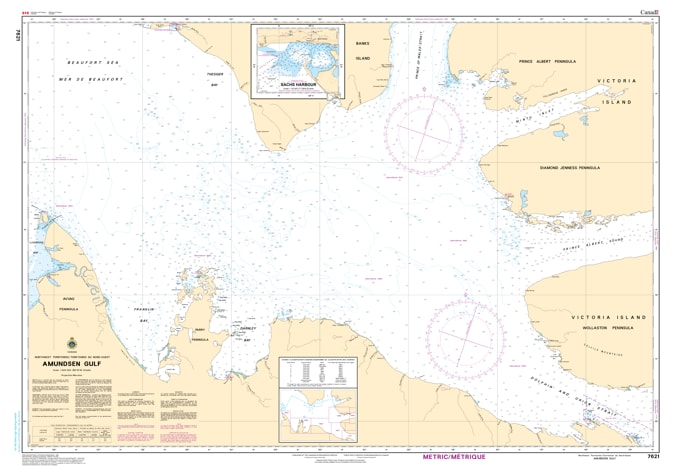
Navigate the vast and challenging waters of Canada’s Western Arctic with the professional authority of the Canadian Hydrographic Service (CHS). Chart 7621 is the definitive "road map" for the Amundsen Gulf, providing the high-latitude precision required for safe passage through this critical link between the Beaufort Sea and the Dolphin and Union Strait.
The Amundsen Gulf is a dynamic environment where bathymetric accuracy is vital for avoiding submerged hazards in one of the world's most remote maritime corridors. CHS Chart 7621 provides the essential data for:
Strategic Arctic Transit: Provides the "big picture" bathymetry necessary for deep-draft commercial vessels and expedition cruise ships navigating the southern route of the Northwest Passage.
Community Supply & Sealift: Essential for vessels servicing northern communities such as Ulukhaktok (Holman) and Sachs Harbour, ensuring safe approaches to coastal discharge points.
Complex Seafloor Morphology: Displays the nature of the sea bottom and water depths, critical for anchoring and research operations in the sensitive Arctic ecosystem.
Coastal Characteristics: Provides detailed configuration of the Banks Island and Victoria Island coastlines, aiding in visual pilotage and radar positioning in extreme northern conditions.
With the increasing development of northern ocean resources and the expansion of Arctic maritime traffic, the role of Chart 7621 is more vital than ever. Whether you are a captain of an ice-strengthened tanker, an Arctic researcher, or an expedition navigator, this official CHS chart provides the "ground-truth" data required to ensure the safe navigation of the Amundsen Gulf.
| Feature | Details |
| Chart Number | 7621 |
| Region | Western Arctic (Amundsen Gulf / NWT) |
| Publisher | Canadian Hydrographic Service (CHS) |
| Key Coverage | Amundsen Gulf, Banks Island (South), Victoria Island (West) |
| Scale | Regional Navigation Scale |
| Vessel Compliance | Meets official carriage requirements for Arctic waters (Zone 13/14) |