QUESTIONS? CALL OR TEXT! 1 (877) 921-6277 or (403) 266-2241
WE SHIP EVERYWHERE!

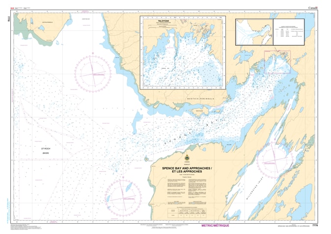
Navigate the remote and challenging reaches of the Kitikmeot Region with the professional authority of the Canadian Hydrographic Service (CHS). Chart 7770 is the essential navigational guide for Spence Bay and its approaches, providing the specialized data required for safe entry into Taloyoak, the gateway to the Boothia Peninsula.
Taloyoak is a vital hub for community resupply and Arctic exploration. Because these waters are characterized by complex tidal movements and seasonal ice, CHS Chart 7770 provides "ground-truth" data essential for:
Critical Harbour Approaches: Features large-scale detail for the inner reaches of Spence Bay, ensuring safe passage for sealift barges and research vessels approaching the Taloyoak wharf.
Complex Coastal Bathymetry: Provides accurate depth soundings for the surrounding inlets, helping mariners avoid the submerged rocks and shoals typical of the St. Roch Basin.
Ice-Scoured Seafloor Data: Identifies the nature of the sea bottom, vital for selecting secure anchorage points in a region where heavy ice can influence vessel stability.
Topographical Orientation: Clearly displays the configuration of the coast and local elevations, which are indispensable for visual pilotage along the rugged shores of the Boothia Peninsula.
With increasing interest in the southern route of the Northwest Passage and the growth of Arctic eco-tourism, the role of Chart 7770 is more vital than ever. Whether you are a captain of a northern supply fleet, a marine biologist, or a specialized expedition navigator, this official CHS "road map" provides the precision required to navigate Nunavut's central Arctic waters with confidence.
| Feature | Details |
| Chart Number | 7770 |
| Region | Central Arctic (Nunavut - Kitikmeot) |
| Type | Harbour and Approaches (Large Scale) |
| Publisher | Canadian Hydrographic Service (CHS) |
| Key Coverage | Spence Bay, Taloyoak Harbour, St. Roch Basin Approaches |
| Vessel Compliance | Meets official carriage requirements for Arctic Waters (Zone 16) |