QUESTIONS? CALL OR TEXT! 1 (877) 921-6277 or (403) 266-2241
WE SHIP EVERYWHERE!

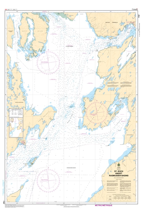
Navigate one of the most historically significant and technically demanding segments of the Canadian Arctic with the professional authority of the Canadian Hydrographic Service (CHS). Chart 7787 is the definitive navigational authority for the St. Roch and Rasmussen Basins, covering the vital transit corridor used by mariners heading toward Gjoa Haven and the Rae Strait.
The Rasmussen Basin is notorious for its relatively shallow depths and complex magnetic variations, making high-quality hydrographic data an absolute requirement. CHS Chart 7787 provides the "ground-truth" data required for:
Strategic Southern Route Transit: Offers the bathymetry necessary for expedition cruise ships and specialized tankers navigating the "Amundsen Route" of the Northwest Passage.
Community Sealift Safety: Essential for tug-and-barge operations servicing Taloyoak and Gjoa Haven, ensuring safe passage through narrow coastal shelves.
Hazard & Shoal Identification: Clearly marks the submerged rocks and shifting sediment banks that characterize these basins, protecting vessels from the unique dangers of the central Arctic.
Seabed Nature & Anchorage: Provides detailed information on seafloor composition, critical for mariners needing to anchor while waiting for ice leads to open in the St. Roch Basin.
As the Arctic navigation season expands, the role of Chart 7787 is more vital than ever for the development of northern resources and the safety of maritime commerce. Whether you are a captain of a northern supply vessel or a specialized Arctic researcher, this official CHS chart provides the precision required to show the configuration of the coast, dangers, and aids to navigation.
| Feature | Details |
| Chart Number | 7787 |
| Region | Central Arctic (Nunavut - Kitikmeot) |
| Publisher | Canadian Hydrographic Service (CHS) |
| Key Coverage | St. Roch Basin, Rasmussen Basin, Rae Strait, Boothia Peninsula |
| Scale | Regional Navigation Scale |
| Vessel Compliance | Meets official carriage requirements for Arctic Waters (Zone 16/17) |