QUESTIONS? CALL OR TEXT! 1 (877) 921-6277 or (403) 266-2241
WE SHIP EVERYWHERE!

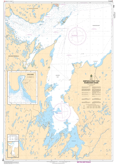
Navigate the most intricate segment of the legendary Northwest Passage with the professional authority of the Canadian Hydrographic Service (CHS). Chart 7788 is the definitive navigational guide for the Simpson Strait, the narrow waterway separating King William Island from the mainland, leading into the vast Rasmussen Basin.
The Simpson Strait is famous among Arctic mariners for its extreme narrowness and shallow depths, which require absolute concentration and the most accurate data available. CHS Chart 7788 provides the "ground-truth" data required for:
High-Stakes Passage Planning: Features large-scale detail for the tightest bends of the Simpson Strait, essential for expedition vessels and community sealift barges.
Approach to Gjoa Haven: Provides the necessary bathymetry for safely entering the harbor at Gjoa Haven (Uqsuqtuuq), the only permanent settlement on King William Island.
Hazard & Rock Identification: Explicitly marks the numerous submerged rocks and shoals that make this region a "pilotage-only" experience for many mariners.
Tidal & Seafloor Data: Identifies the nature of the sea bottom and elevations, helping mariners understand the complex currents and grounding risks inherent in this corridor.
With the expansion of Arctic research and the continued interest in the history of the Franklin Expedition, the role of Chart 7788 is more vital than ever. Whether you are a captain of a specialized Arctic cruise ship or a logistics officer for a northern resupply mission, this official CHS chart ensures you have the configuration, dangers, and aids to navigation required for a successful transit.
| Feature | Details |
| Chart Number | 7788 |
| Region | Central Arctic (Nunavut - Kitikmeot) |
| Publisher | Canadian Hydrographic Service (CHS) |
| Key Coverage | Simpson Strait, Gjoa Haven, Eastern King William Island |
| Scale | Large-Scale Passage Detail |
| Vessel Compliance | Meets official carriage requirements for Arctic Waters (Zone 17) |