QUESTIONS? CALL OR TEXT! 1 (877) 921-6277 or (403) 266-2241
WE SHIP EVERYWHERE!

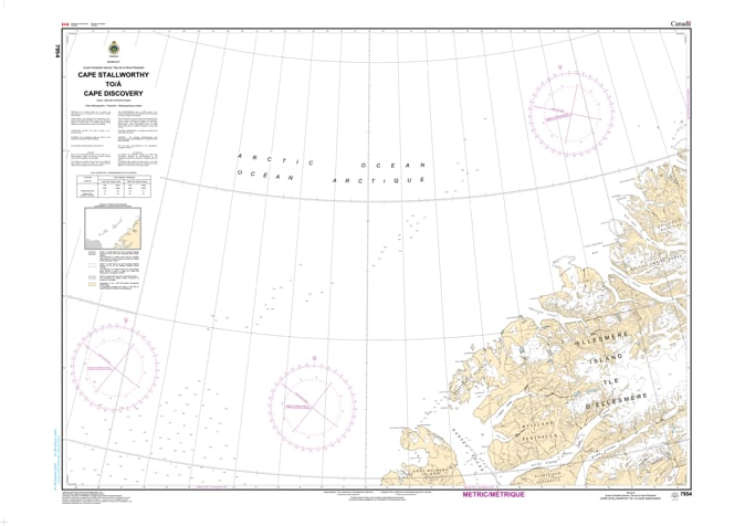
Navigate the northernmost boundary of the Canadian Arctic Archipelago with the professional authority of the Canadian Hydrographic Service (CHS). Chart 7954 is the definitive navigational authority for the extreme northern coast of Ellesmere Island, providing essential coverage from Cape Stallworthy (the northern tip of Axel Heiberg Island) to Cape Discovery.
As the final maritime transition before the vast Arctic Ocean, the waters of the northern Ellesmere coast are characterized by dramatic topography and dynamic polar pack ice. CHS Chart 7954 provides the "ground-truth" data required for:
Strategic Polar Passage: A broad-scale 1:500,000 overview designed for long-range navigation and expedition planning in the most isolated maritime environment on Earth.
High-Latitude Bathymetry: Provides accurate depth soundings and seafloor characteristics—crucial for icebreakers and specialized research vessels navigating the shelf waters of the Lincoln Sea.
Coastal Configuration & Landfall: Features detailed mapping of the rugged coastlines, identifying deep fiords like M'Clintock Inlet and the imposing elevations of the British Empire Range.
Ice-Dynamic Safety: Includes essential data on seafloor nature and coastal characteristics, aiding mariners in visual pilotage where navigation aids are virtually non-existent and magnetic variation is extreme.
With the expansion of international climate research and the increasing frequency of high-latitude scientific missions, the role of Chart 7954 is more vital than ever. Whether you are leading a polar oceanography study or a specialized High Arctic expedition, this official CHS "road map" provides the accuracy and reliability needed to navigate the configuration, dangers, and characteristics of the world's most northerly coastline.
| Feature | Details |
| Chart Number | 7954 |
| Region | High Arctic (Ellesmere Island, Nunavut) |
| Scale | 1:500,000 (Sailing / General Navigation) |
| Publisher | Canadian Hydrographic Service (CHS) |
| Key Coverage | Cape Stallworthy, Cape Discovery, M'Clintock Inlet, Northern Ellesmere Island |
| Vessel Compliance | Meets SOLAS and Arctic Waters Pollution Prevention Act requirements |