QUESTIONS? CALL OR TEXT! 1 (877) 921-6277 or (403) 266-2241
WE SHIP EVERYWHERE!



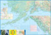
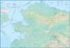
Planning a road trip, ferry journey, or expedition through Alaska? This indispensable double-sided map is the only guide you need for seamless navigation and detailed trip planning across the state.
We've broken down Alaska's massive geography for you: one side covers the vast northern portion, while the reverse focuses on the highly-visited southern regions, including the beautiful Aleutian Islands, the rugged Kenai Peninsula, and the ferry-dependent ‘panhandle’.
Comprehensive Road Network: Clearly marked roads by classification, making it easy to distinguish between major highways and secondary routes.
Ferry Routes: Essential for coastal travel, all major ferry routes are included.
Pan-Americana Link: See the crucial northernmost segment of the famed Pan-Americana Adventure Highway.
Alaska travel requires more than just roads. This map includes critical logistical and safety data necessary for remote travel:
Critical Access Points: Easily locate International and Domestic Airports and key Border Crossings.
Emergency & Support: Find essential services like Hospitals and Visitor Centers—vital information in remote areas.
Marine Detail: Navigate the coasts with markers for Harbors, Light houses, and Marine Protected Areas.
The map highlights major attractions, parks, and designated hiking areas to help you plan your outdoor activities. You’ll even find unique points of interest like Fishing Boat Lunches and other specialized geographical markers.
Don't start your Alaskan adventure without it. Get your Alaska Travel & Road Map today!