QUESTIONS? CALL OR TEXT! 1 (877) 921-6277 or (403) 266-2241
WE SHIP EVERYWHERE!


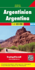
Embark on the ultimate South American road trip with the Argentina Travel & Road Map by Freytag & Berndt. This comprehensive, double-sided map is the gold standard for navigating Argentina’s vast landscapes, from the tropical Iguazú Falls in the north to the rugged tip of Tierra del Fuego.
At a detailed 1:1,500,000 scale, this map is specifically designed for long-distance drivers and adventure travelers. Whether you are traversing the iconic Ruta Nacional 40 or exploring the vineyards of Mendoza, this map provides the clarity and technical detail that GPS often misses in remote regions.
All-Weather Durability: Printed on high-quality waterproof and tear-proof material, ensuring it survives the winds of Patagonia and the humidity of the rainforest.
City & Regional Detail: Includes inset maps for major hubs including Buenos Aires, Córdoba, and Rosario, plus a comprehensive index of places for quick orientation.
Point of Interest (POI) Mapping: Clearly marked national parks, UNESCO World Heritage sites, campsites, and tourist information centers.
Driving Logistics: Features accurate distance markers in kilometers, road classifications (paved vs. unpaved), and mountain pass information.
Multi-Language Legend: Accessible for international travelers with legends in English, Spanish, German, and more.
GPS Compatible: Includes latitude/longitude markings and a 1km UTM grid for syncing with digital devices.
Topographic Clarity: Features shaded relief to help visualize the dramatic ascent of the Andes mountains.
| Feature | Details |
| Publisher | Freytag & Berndt |
| Scale | 1:1,500,000 |
| Coverage | Full Country (North & South Sheets) |
| Special Features | City Insets, Index of Places, Distance Table |