QUESTIONS? CALL OR TEXT! 1 (877) 921-6277 or (403) 266-2241
WE SHIP EVERYWHERE!


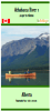


Embark on a journey through history with the definitive guide to the Athabasca River. Map #1 is the essential 1:100,000 scale topographic resource for the 85km stretch from Jasper to Hinton. This is the first in a specialized seven-map series extending all the way to Calling River, meticulously developed with the expert assistance of Paddle Alberta, Mark Lund, and Dale Kiselyk.
The stretch from Jasper to Hinton features Grade I+ water and stunning views of the snow-capped Rockies. This map provides the "ground-truth" data required for safe passage:
Shaded Relief Topography: Features detailed contouring and shaded relief to help paddlers visualize the surrounding valley and landmarks.
Detailed Route Coverage: Expertly annotated to identify safe river channels, potential hazards, and scenic highlights along this Canadian Heritage River.
Professional Standards: Meets the high accuracy requirements of both commercial outfitters and experienced backcountry paddlers.
| Feature | Details |
| Chart Number | Athabasca River 01 (TNM225s) |
| Scale | 1:100,000 |
| Region | Jasper National Park to Hinton, Alberta |
| Weight | Approx. 0.20 KGS |
| Series | Map 1 of 7 (Jasper to Calling River) |