QUESTIONS? CALL OR TEXT! 1 (877) 921-6277 or (403) 266-2241
WE SHIP EVERYWHERE!

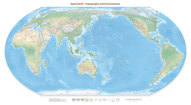
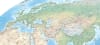
Broaden your global perspective with the Equal Earth Physical Map, expertly centered on 150° East to place Australia, Asia, and the Pacific Rim at the heart of the world. This version of the award-winning Equal Earth projection eliminates the traditional Atlantic-centric bias, offering a more relevant view for residents, students, and businesses across the Asia-Pacific region.
Unlike the common Mercator projection, the Equal Earth projection is an equal-area pseudocylindrical map. This means it maintains the true relative sizes of all landmasses—finally showing that Africa and South America are significantly larger than traditional maps suggest, while Australia is presented in its correct, expansive proportion.
Exaggerated Shaded Relief: Features 3D-rendered digital models that bring the Great Dividing Range, the Himalayas, and the Indonesian archipelago to life.
Dynamic Ocean Topography: Includes detailed bathymetric tints that reveal the complex geography of the Pacific Floor, including the Mariana Trench and the Mid-Ocean Ridges.
Natural World Focus: This physical version highlights biomes and terrain—from the vast deserts of the Australian Outback to the lush rainforests of Southeast Asia—free of distracting political borders.
Professional Reference: Includes over 3,000 labels for major physical features, mountain peaks (labeled in meters), rivers, and basins, providing a wealth of geographic data.
The 55" x 30" (140 x 77 cm) format is designed for maximum impact in classrooms, lecture halls, and offices. Delivered at a crisp 350 DPI, this high-resolution raster map ensures that every island chain and coral reef in the Pacific is rendered with absolute clarity.