QUESTIONS? CALL OR TEXT! 1 (877) 921-6277 or (403) 266-2241
WE SHIP EVERYWHERE!


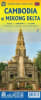


Planning an adventure through the historic temples of Cambodia and the intricate waterways of Vietnam's Mekong Delta? This definitive, double-sided ITMB travel map is the only guide you need for seamless navigation between these two incredible destinations.
Published by International Travel Maps (ITMB), this map is engineered for travelers exploring Southeast Asia's most captivating regions.
This map offers two complete, highly detailed maps on a single, convenient sheet:
Side 1: Cambodia: Covers the entire country of Cambodia, from the capital Phnom Penh to the ancient temples of Angkor Wat (near Siem Reap). This side is essential for road trips and locating key tourist sites.
Side 2: Vietnam’s Mekong Delta: Provides an incredibly detailed view of the vast Mekong Delta region in Southern Vietnam, including the primary river channels, countless canals, and major cities like Ho Chi Minh City (Saigon) and Can Tho.
Crucially, the map clearly shows the main transport links—road and river—between Phnom Penh (Cambodia) and Ho Chi Minh City / Saigon (Vietnam), making it perfect for multi-country itinerary planning.
This map’s legend ensures you can locate every point of interest, from major hubs to secluded sites:
Key Destinations: Cities, Major Towns, and Villages in both Cambodia and the Mekong Delta.
Infrastructure: Detailed road network (highways, primary, secondary roads), Airports, and Border Crossings.
Natural Features: Classification of Rivers, Lakes, and National Parks.
Points of Interest: Clearly marked Angkor Wat complex, temples, historical sites, and other tourist attractions.
This Mekong Delta and Cambodia map is printed on durable, high-quality paper, built to withstand the rigors of travel through the hot, humid climates of Southeast Asia. It is easy to fold, easy to read, and an invaluable tool for backpackers, river cruise travelers, and road trippers alike.