QUESTIONS? CALL OR TEXT! 1 (877) 921-6277 or (403) 266-2241
WE SHIP EVERYWHERE!

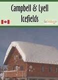
The topographic maps are a valuable resource as they provide detailed information on the terrain, elevation, and slope angle. This is particularly important for winter activities, where the risk of avalanches is high. The shading on the map helps to provide a clear understanding of the terrain's topography, making it easier to navigate and plan your route.
The winter activity map is specifically designed to help skiers and glacier navigators plan their trips effectively. The map provides information on key features such as trails, slopes, and glaciers, as well as other relevant information such as access points and parking areas. With this map, you can plan your route, assess the terrain, and navigate with confidence, ensuring a safe and enjoyable winter activity experience.
Overall, the winter activity map is an essential tool for anyone engaging in winter activities in the area that straddles Alberta and British Columbia. Its detailed topographic maps and shading, coupled with essential information on key features and access points, make it an invaluable resource for any winter adventurer.