QUESTIONS? CALL OR TEXT! 1 (877) 921-6277 or (403) 266-2241
WE SHIP EVERYWHERE!

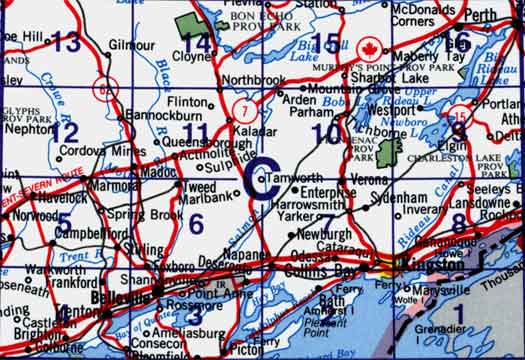
Use the following image to move to adjacent topo map indexes.
Back to the Block 031 Topographic Map Index.
31C - Kingston, 31C01 - Wolfe Island, 31C02 - Bath, 31C03 - Belleville, 31C04 - Trenton, 31C05 - Campbellford, 31C06 - Tweed, 31C07 - Sydenham, 31C08 - Gananoque, 31C09 - Westport, 31C10 - Tichborne, 31C11 - Kaladar, 31C12 - Bannockburn, 31C13 - Coe Hill, 31C14 - Bon Echo, 31C15 - Sharbot Lake, 31C16 - Perth. One or more of these maps cover Bon Echo Provincial Park, Charleston Lake Provincial Park, Murphy's Point Provincial Park and Frontenac Provincial Park