QUESTIONS? CALL OR TEXT! 1 (877) 921-6277 or (403) 266-2241
WE SHIP EVERYWHERE!

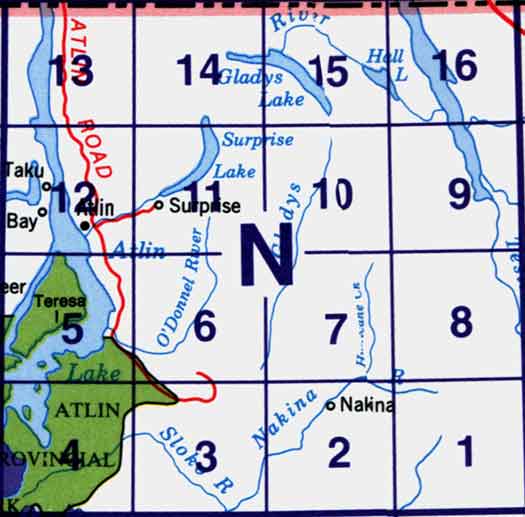
Use the following image to move to adjacent topo map indexes.
Back to the Block 104 Topographic Map Index.
104N - Atlin, 104N01E - Nakina Lake, 104N01W - Nakina Lake, 104N02E - Nakina, 104N02W - Nakina, 104N03 - Sloko River, 104N04 - Sloko Lake, 104N05 - Teresa Island, 104N06 - Dixie Lake, 104N07 - Bell Lake, 104N08 - Hayes Peak, 104N09 - Goodwin Creek, 104N10 - Eva Lake, 104N11 - Surprise Lake, 104N12 - Atlin, 104N13 - Mount Minto, 104N14 - Consolation Creek, 104N15 - Gladys Lake, 104N16 - Gladys River. One or more of these maps cover a portion of Atlin Provincial Park