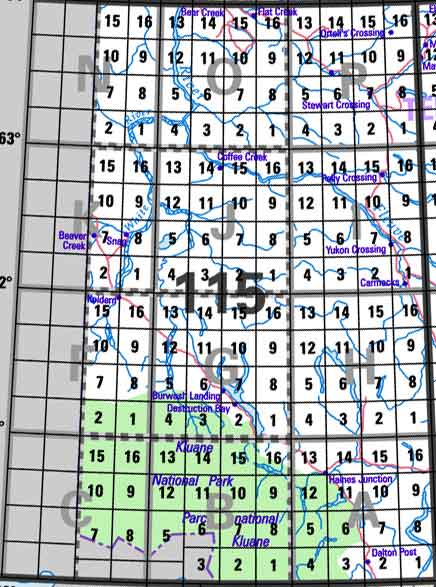
Natural Resources Canada - Topo Maps
Natural Resources Canada - Topo Maps
Natural Resources Canada - Topo Maps
Natural Resources Canada - Topo Maps
Natural Resources Canada - Topo Maps
Natural Resources Canada - Topo Maps
Natural Resources Canada - Topo Maps
Natural Resources Canada - Topo Maps
Natural Resources Canada - Topo Maps
Natural Resources Canada - Topo Maps
Natural Resources Canada - Topo Maps
Natural Resources Canada - Topo Maps
Natural Resources Canada - Topo Maps
Natural Resources Canada - Topo Maps
Natural Resources Canada - Topo Maps
Natural Resources Canada - Topo Maps
Natural Resources Canada - Topo Maps
Natural Resources Canada - Topo Maps
Natural Resources Canada - Topo Maps
Natural Resources Canada - Topo Maps
Natural Resources Canada - Topo Maps
Natural Resources Canada - Topo Maps
Natural Resources Canada - Topo Maps
Natural Resources Canada - Topo Maps
Natural Resources Canada - Topo Maps
Natural Resources Canada - Topo Maps
Natural Resources Canada - Topo Maps
Natural Resources Canada - Topo Maps
Natural Resources Canada - Topo Maps
Natural Resources Canada - Topo Maps
Natural Resources Canada - Topo Maps
Natural Resources Canada - Topo Maps
Natural Resources Canada - Topo Maps
Natural Resources Canada - Topo Maps
Natural Resources Canada - Topo Maps
Natural Resources Canada - Topo Maps
Natural Resources Canada - Topo Maps
Natural Resources Canada - Topo Maps
Natural Resources Canada - Topo Maps
Natural Resources Canada - Topo Maps
Natural Resources Canada - Topo Maps
Natural Resources Canada - Topo Maps
Natural Resources Canada - Topo Maps
Natural Resources Canada - Topo Maps
Natural Resources Canada - Topo Maps
Natural Resources Canada - Topo Maps
Natural Resources Canada - Topo Maps
Natural Resources Canada - Topo Maps
Natural Resources Canada - Topo Maps
Natural Resources Canada - Topo Maps
Natural Resources Canada - Topo Maps
Natural Resources Canada - Topo Maps
Natural Resources Canada - Topo Maps
Natural Resources Canada - Topo Maps
Natural Resources Canada - Topo Maps
Natural Resources Canada - Topo Maps
Natural Resources Canada - Topo Maps
Natural Resources Canada - Topo Maps
Natural Resources Canada - Topo Maps
Natural Resources Canada - Topo Maps
Natural Resources Canada - Topo Maps
Natural Resources Canada - Topo Maps
Natural Resources Canada - Topo Maps
Natural Resources Canada - Topo Maps
Natural Resources Canada - Topo Maps
Natural Resources Canada - Topo Maps
Natural Resources Canada - Topo Maps
Natural Resources Canada - Topo Maps
Natural Resources Canada - Topo Maps
Natural Resources Canada - Topo Maps
Natural Resources Canada - Topo Maps
Natural Resources Canada - Topo Maps
Natural Resources Canada - Topo Maps
Natural Resources Canada - Topo Maps
Natural Resources Canada - Topo Maps
Natural Resources Canada - Topo Maps
Natural Resources Canada - Topo Maps
Natural Resources Canada - Topo Maps
Natural Resources Canada - Topo Maps
Natural Resources Canada - Topo Maps
Natural Resources Canada - Topo Maps
Natural Resources Canada - Topo Maps
Natural Resources Canada - Topo Maps
Natural Resources Canada - Topo Maps
Natural Resources Canada - Topo Maps
Natural Resources Canada - Topo Maps
Natural Resources Canada - Topo Maps
Natural Resources Canada - Topo Maps
Natural Resources Canada - Topo Maps
Natural Resources Canada - Topo Maps
Natural Resources Canada - Topo Maps
Natural Resources Canada - Topo Maps
Natural Resources Canada - Topo Maps
Natural Resources Canada - Topo Maps
Natural Resources Canada - Topo Maps
Natural Resources Canada - Topo Maps
Natural Resources Canada - Topo Maps
Natural Resources Canada - Topo Maps
Natural Resources Canada - Topo Maps
Natural Resources Canada - Topo Maps