QUESTIONS? CALL OR TEXT! 1 (877) 921-6277 or (403) 266-2241
WE SHIP EVERYWHERE!

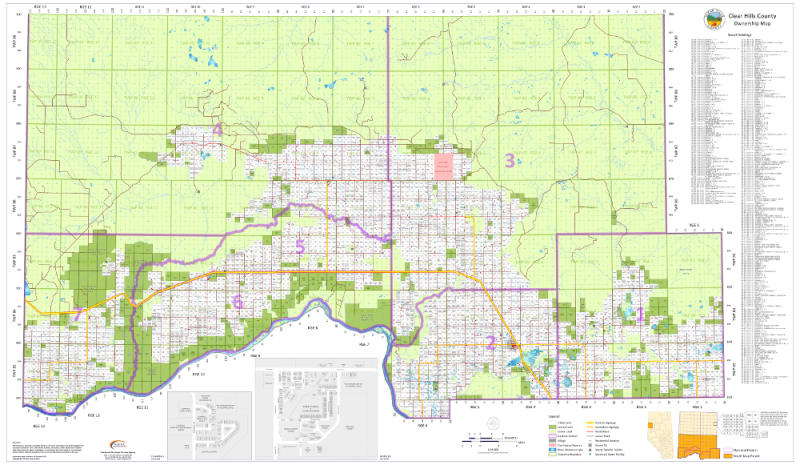


Situated in the heart of the Peace Country, Clear Hills County (MD 21) is a region defined by its rich agricultural heritage and vast natural resources. This professional-grade landowner map is the definitive tool for property identification, rural navigation, and resource management along the Alberta-BC border.
Surface Land Ownership: Every quarter section is clearly labeled with the current owner's name, providing essential data for agricultural planning and industry access.
Land Status Color-Coding: Navigate public and private boundaries with confidence:
Freehold (Private): Visualizes standard private ownership.
Crown (Government): Identifies provincial and federal holdings.
Crown Leased: Highlights government land under lease (essential for grazing and industry).
Urban & Rural Communities: Includes the Village of Hines Creek and the hamlets of Worsley and Cleardale, as well as local settlements like Bear Canyon and Cherry Point.
Precise Navigation: Features the most current road data, including Township Roads, Range Roads, and major arteries like Highway 64.
Topographic & Water Features: Shows the Peace River, local lakes, and provincial parks for comprehensive regional context.