QUESTIONS? CALL OR TEXT! 1 (877) 921-6277 or (403) 266-2241
WE SHIP EVERYWHERE!

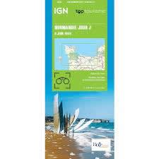
Relive the "Longest Day" with the most comprehensive tactical and commemorative map of the Normandy invasion. This multilingual guide (English, French, German) is an indispensable tool for historians, students, and travelers visiting the sacred ground where the liberation of Europe began.
From the amphibious assaults on the five beaches to the daring inland drops of the airborne divisions, this map provides a clear, high-contrast visualization of Operation Overlord.
The Five Sectors: Clearly navigate the landing zones of Utah, Omaha, Gold, Juno, and Sword, with detailed annotations on the British, American, and Canadian forces involved.
Force Advancement: Track the "Screaming Eagles" and "All-American" airborne divisions through their drop zones at Sainte-Mère-Église and beyond, and see the line of Allied advancement in the crucial months following the invasion.
Commemorative Memorial Guide: Our specialized Memorial Site Map marks every essential cemetery and monument, including the Normandy American Cemetery at Colleville-sur-Mer and the British Memorial at Ver-sur-Mer.
Multilingual Accessibility: Comprehensive legends and historical context provided in English, French, and German.
Key Landmarks: Easily locate Pointe du Hoc, Pegasus Bridge, and the Arromanches Mulberry Harbor remnants.
Strategic Evolution: Observe the progression from the initial beachheads to the liberation of Bayeux and the hard-fought Battle for Caen.
"While modern GPS is excellent for finding a museum's front door, this paper map is the only way to visualize the scale of the 50-mile invasion front. It allows you to see the relationship between the beach landings and the airborne drops—providing the 'God's eye view' that generals Eisenhower and Montgomery used to plan the liberation of a continent."