QUESTIONS? CALL OR TEXT! 1 (877) 921-6277 or (403) 266-2241
WE SHIP EVERYWHERE!



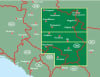
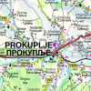
AK0715 Serbia South Road & Travel Map – Niš, Uvac Canyon, and Monasteries
This is the definitive Serbia South Travel Map (AK0715), covering the lower half of the Republic of Serbia, from the main highway south of Belgrade to the borders with North Macedonia, Bulgaria, and Kosovo. Published by Freytag & Berndt, this detailed Southern Serbia Road Map is essential for any road trip or in-depth exploration.
Key Coverage Areas & Attractions:
The map provides unparalleled detail for the most-visited historical and natural sites in the region:
Major Cities: Detailed street coverage and city plans for Niš (the region's capital), Kragujevac, and Novi Pazar.
Natural Wonders: Clearly marks the locations of the Uvac Canyon meanders, Kopaonik National Park, Devil's Town (Đavolja Varoš) rock formations, and Suva Planina.
Culture & History: Pinpoints UNESCO World Heritage Sites and key monasteries, including Studenica Monastery, Žiča, and Sopoćani.
Connectivity: Essential road map for the major E-routes, secondary roads, and local roads, perfect for planning a route from Niš to the North Macedonia border (Skopje).
The most comprehensive tourist and road map for Southeastern Serbia, ideal for discovering national parks and ancient heritage.